Now that I only have a weekend in Washington every other month I’ve had to be really selective about which hikes I do when I visit. Longs Pass has been on my list since we hiked nearby Bean Creek Basin last September and crossed paths with a couple who proclaimed its awesome views. Ingalls Lake is a classic so it’s always been on my mind as a to-do, but we never had a chance to do it as dogs aren’t allowed to the lake. Brainstorming hike ideas with my Seattleite friends we decided to make a loop out of the two premier destinations by following some vague dashed lines on the map marked as unmaintained trails.
My flight was scheduled after work on a Friday night and, to make the weekend even more exciting, I had a procedure done Friday morning to have a cyst removed from my scalp. Don’t worry, the surgeon signed off on me flying and backpacking. But this did make for quite a long day as I had to be at the clinic at 6:30am CT and we didn’t drive up to the trailhead until 12:30am PT. Thanks to our friends Jesse and Kelly for picking me up from the airport so we could get going as quick as possible!
Arriving at the trailhead we discovered we weren’t the only people with the idea of camping there. Kelly and I wandered around a bit trying to find a nice flat spot for our tents but failed to find anything not sloping and ended up setting up next to Jesse’s car at the trailhead. Somehow Jesse managed to sleep in the back of his car even though his feet stick out the end of it! We all quickly fell asleep and the morning came much too soon.
I’ve been sleeping in an OR Helium Bivy my last couple of solo trips and my biggest fear when sleeping near cars is that someone is going to run me over. This fear was amplified after hearing about an incident that had occurred the previous weekend at the Squamish music festival.
At around 5am I woke up in a panic at the sound of a truck rushing toward me. A climbing guide was parking in a nearby spot. I was protected by another vehicle but the sound definitely startled me awake. From there, the noises of the other campers at the trailhead chatting and cooking breakfast along with more cars arriving made sleep futile. After a quick breakfast and a long search for our America the Beautiful pass (which ultimately was found lodged behind the glove box) we were on our way up the trail.
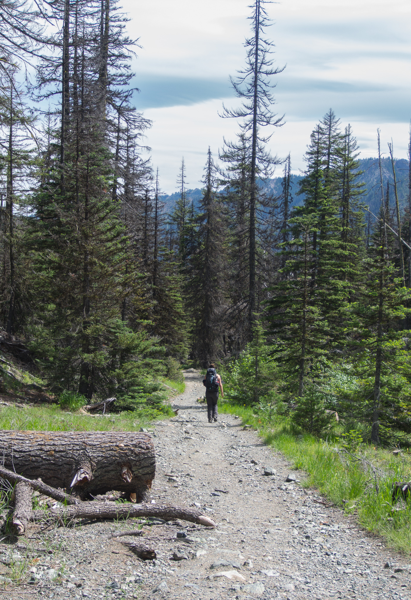
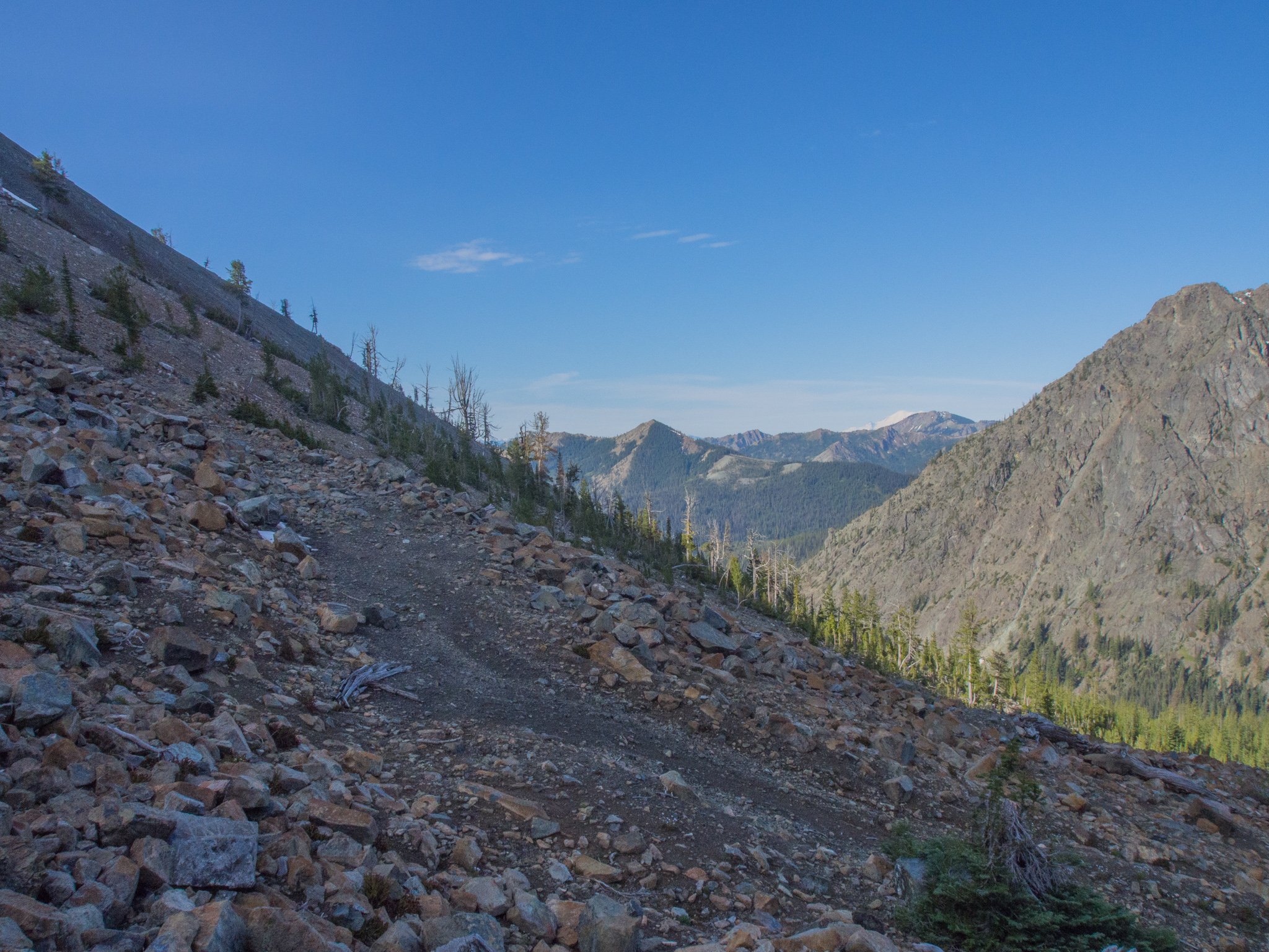
Section of the trail on the old mining road
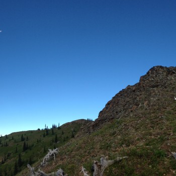
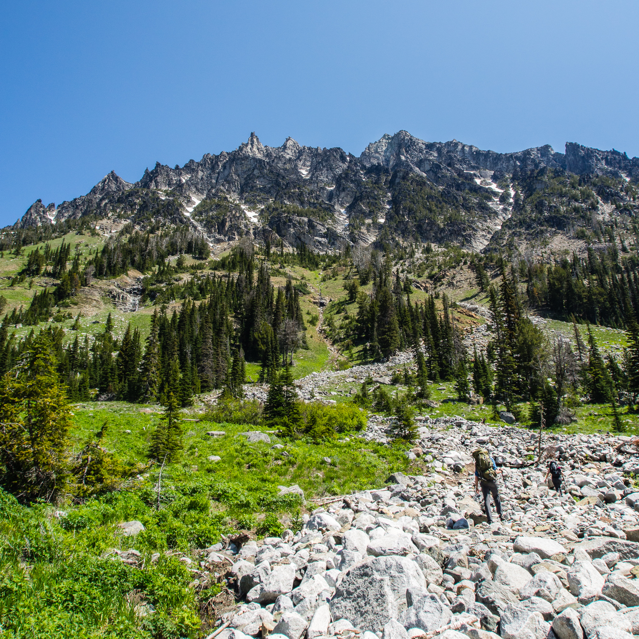
The trail starts on an old mining road following the North Fork of the Teanaway River (it’s more of a creek here). The creek tumbled peacefully beside us as we worked our way up a gentle grade. This first part of the trail is also part of the Esmeralda Basin trail. At the first junction, .3 miles in, we turned right to go to Longs Pass and Ingalls Lake. If we were to continue straight we would’ve ended up at Esmeralda Basin. There was good signage here for us, but Jesse noted when he was here before it wasn’t signed and they ended up going the wrong way.
Esmeralda Peaks in the distance
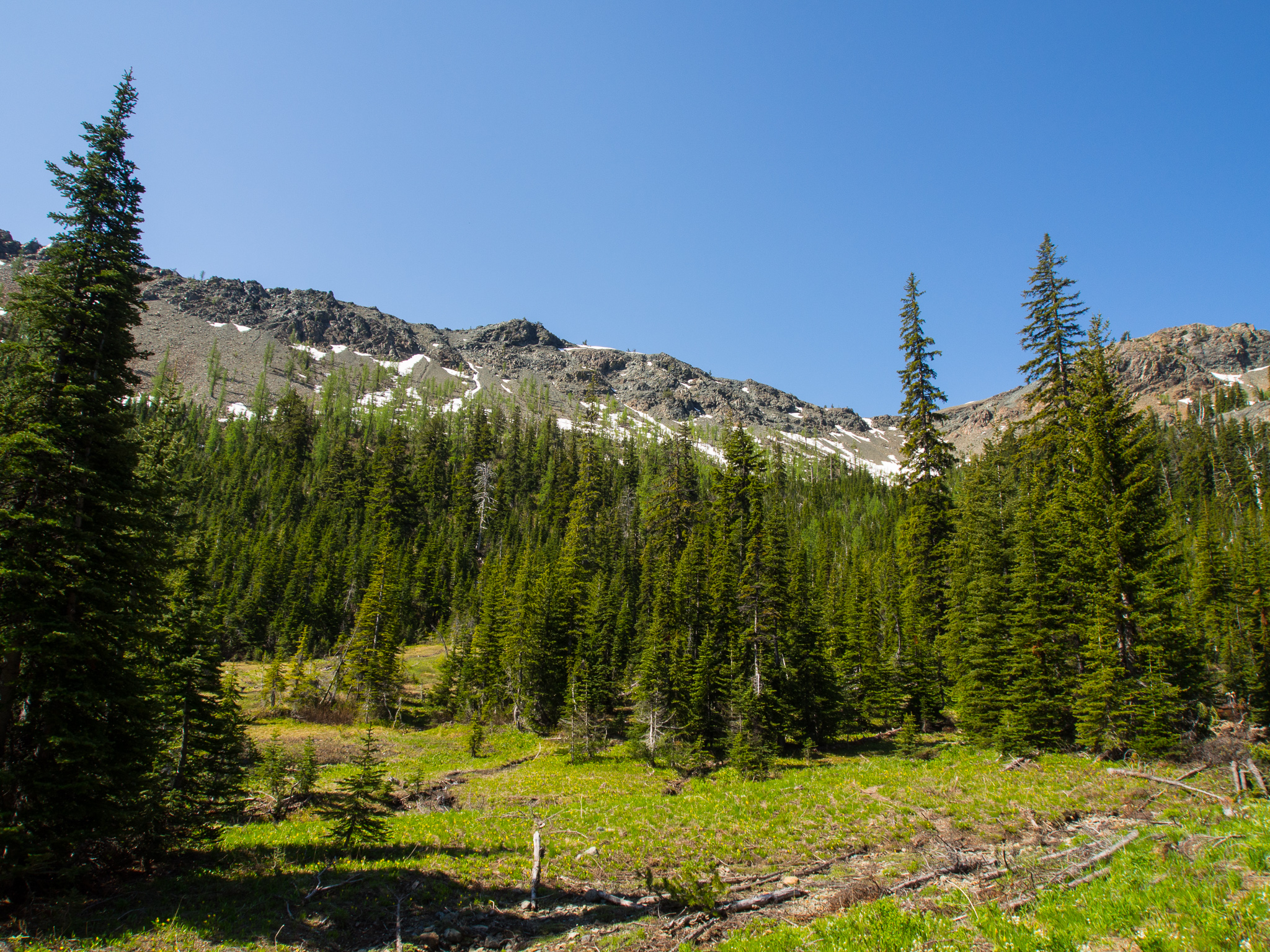
The trail began to climb more steeply and as we worked our way up we enjoyed the ever expanding views as we neared the tree line. As a point of interest, there is an old mining road that follows the trail–if you look between the switchbacks you can see where it used to cut straight up the mountainside.
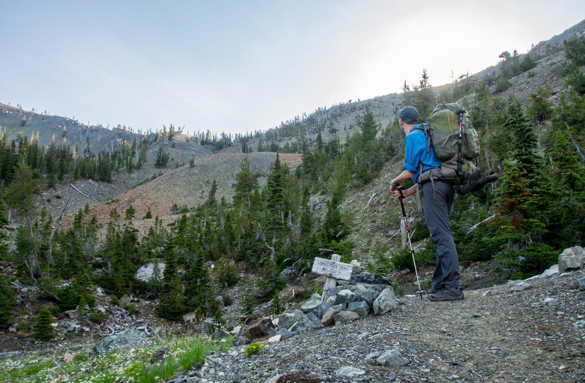
Turn right to go to Longs Pass. Continuing straight goes to Ingalls Lake.
At the 2-mile mark the trail splits again. We headed right to continue on the trail to Longs Pass, continuing straight would take hikers to Ingalls Lake. We were doing the loop counter clockwise to minimize elevation gain (this was a really good decision based on trail conditions! As we’ll soon see…).
Rainier starting to peak out from behind the other mountains. In the foreground you can see fragments of the old mining road.
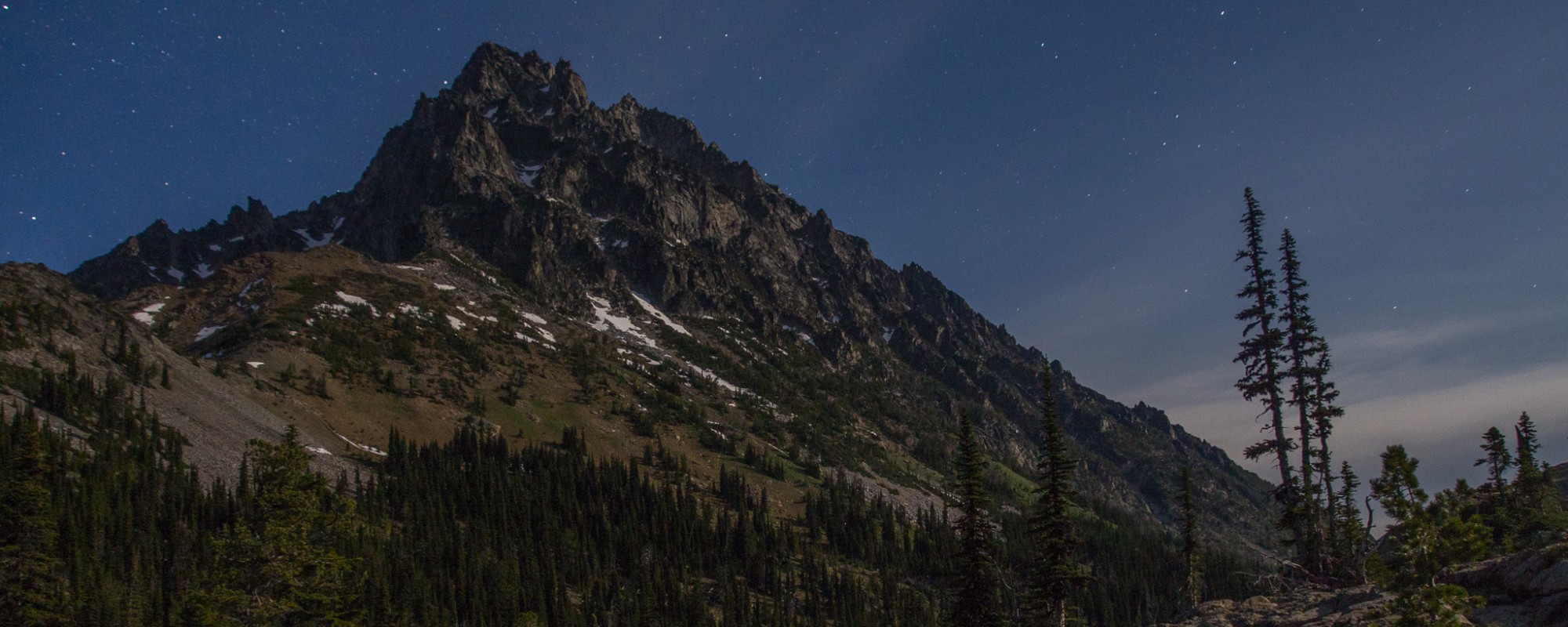
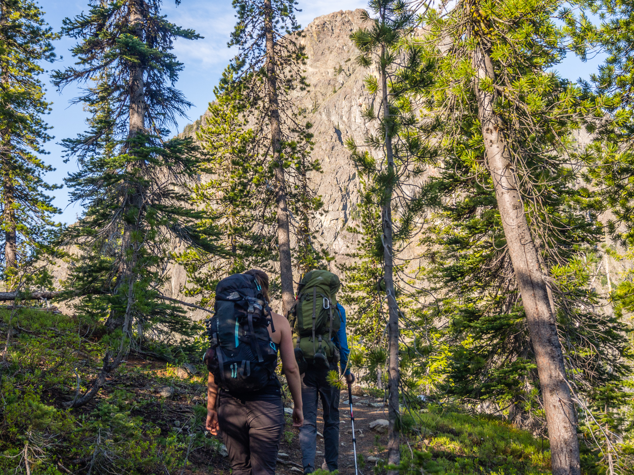
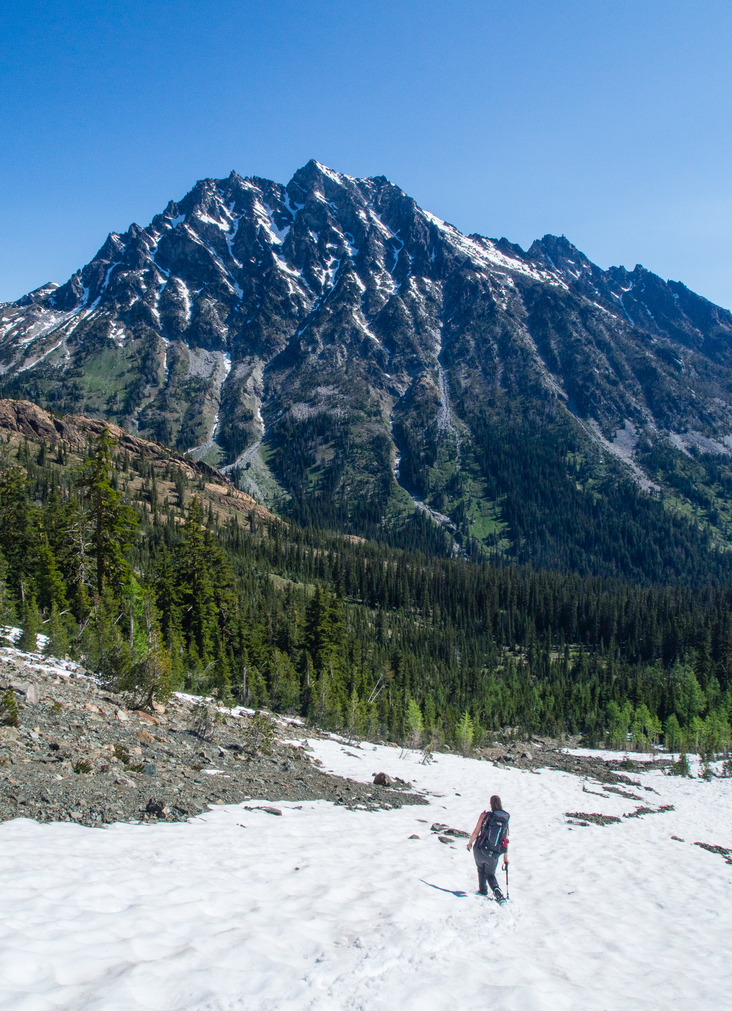
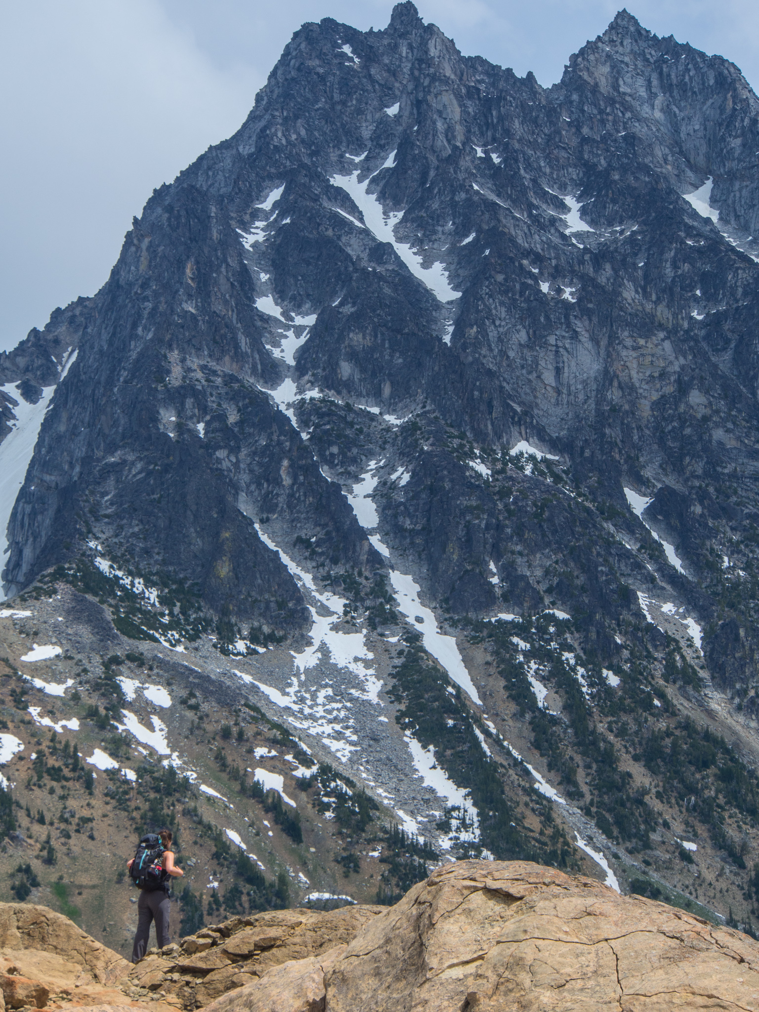
Now above the tree line, we were like kids in a candy store pointing out Rainier and Adams as they popped into view. We also stumbled upon a small herd of deer grazing which I unfortunately failed to get any decent pictures of. We were lucky that the sun hadn’t popped over the ridge yet so we stayed cool for the ascent. This section of trail would be very dry and hot in the sun. Plus, it climbs 600 feet in a half mile of switchbacks through rocks and meadows. Near the top it was hard to follow the trail due to the lack of vegetation so we headed straight up towards the ridge sticking to rocky surfaces to avoid damaging any plants struggling to survive. A few seconds before we reached the ridge we found ourselves looking up and having 9,415 foot Mount Stewart dominating our view. It had us all in awe as we dropped our packs, grabbed some snacks, and started taking a crazy amount of photos.
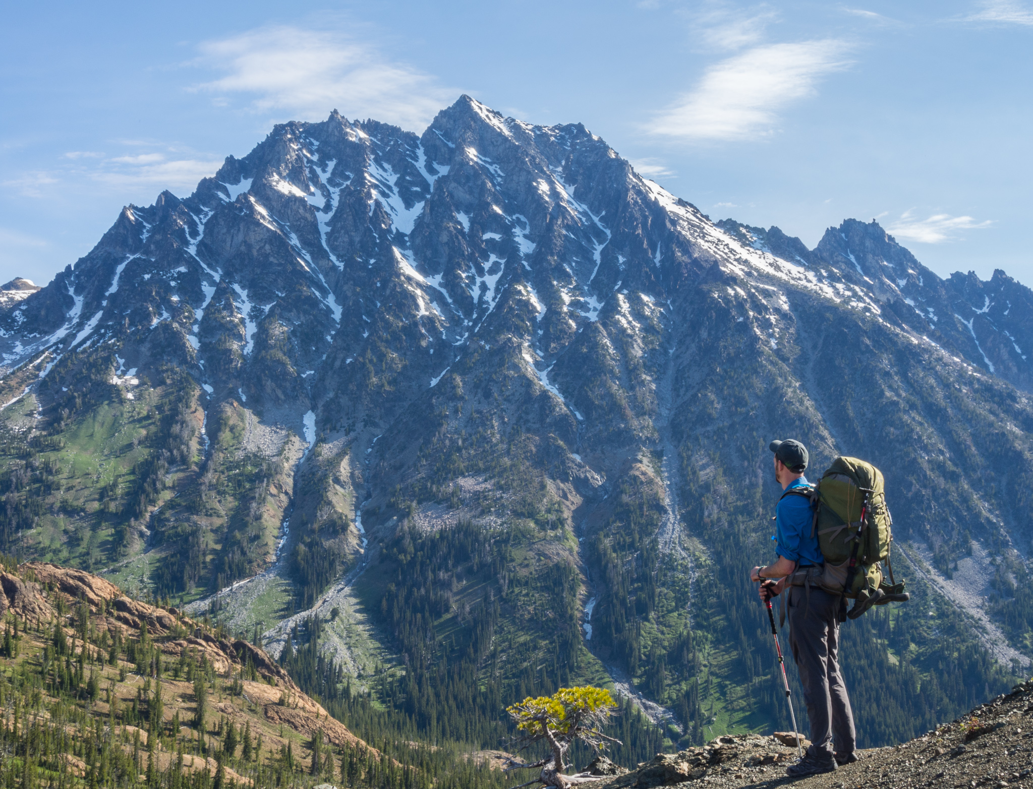
Jaw-dropping views of Mount Stewart
As we enjoyed the literal high point of our trip we were soon accompanied by 2 mountain goats. As they swaggered towards us we started to get nervous that they didn’t seem to mind our presence at all. Not wanting to be gored we decided to continue on our way once they started making noise and ducking their heads in our general direction.
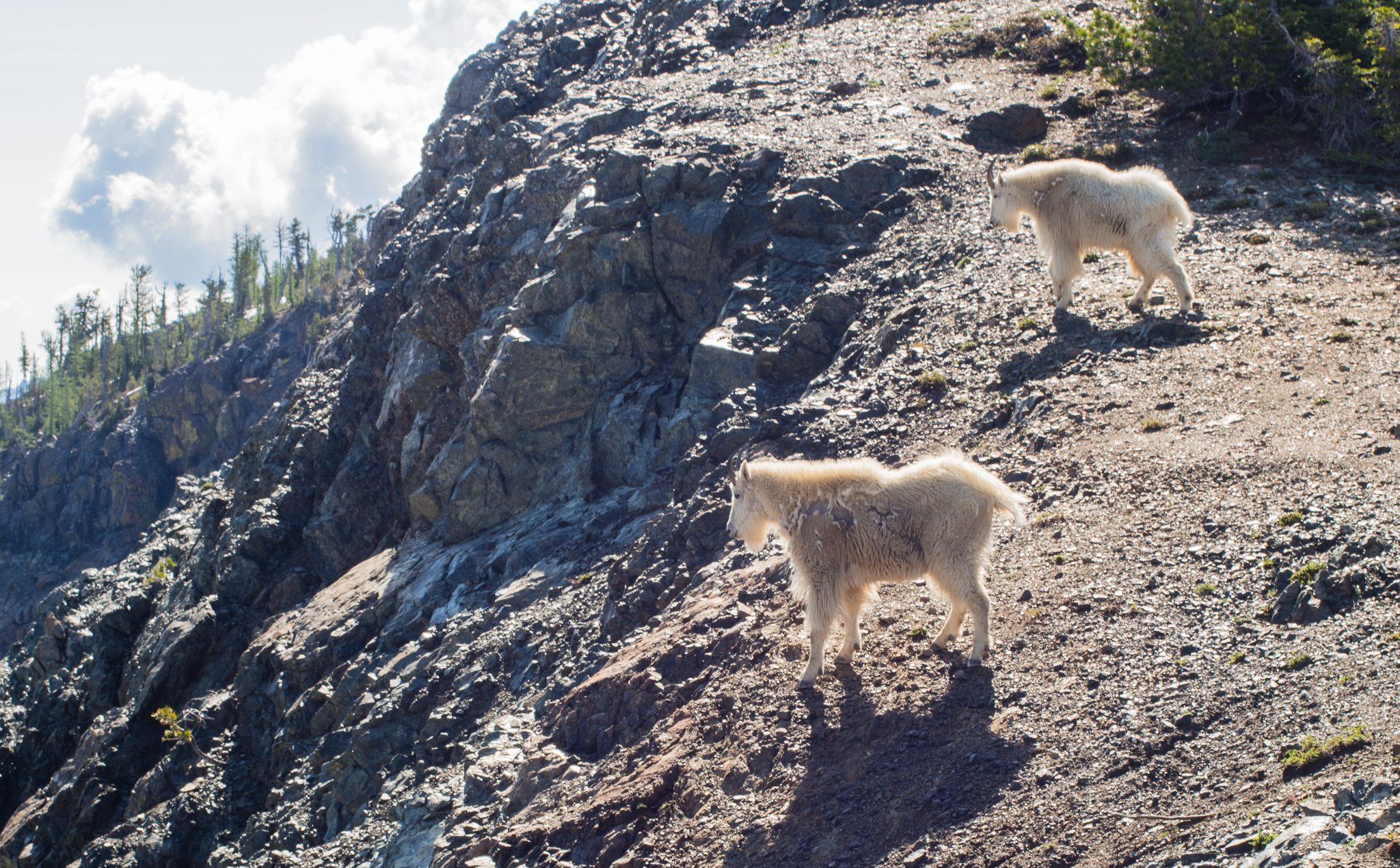
Our ornery goat friends
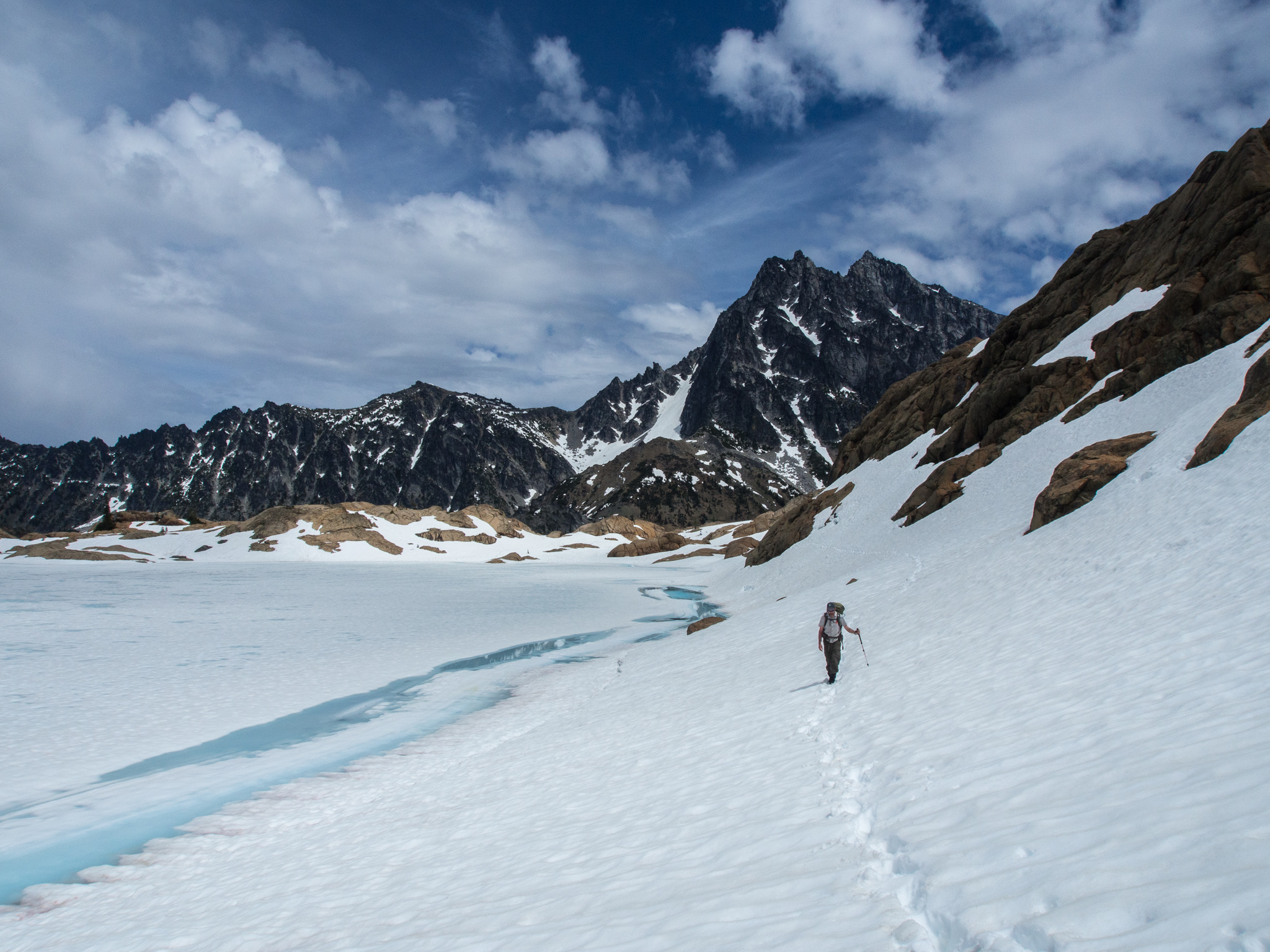
To continue our loop we needed to drop down the opposite side of the ridge towards Ingalls Creek. From the pass it was hard for us to see exactly where the trail went, all we could see were some cliffs and steep talus fields along with a snow field. After some debate we spotted a series of cairns which led us down through the cliffs. Soon we were plunge stepping our way down the snowfield in the general direction of the creek at the bottom of the valley. At the bottom of the snowfield the “trail” continued in the form of a stream fueled by the snowmelt. GPS on Jesse’s phone was very helpful here along with waterproof shoes and gaiters.
This part of the trail made us feel pretty badass. It also made us glad we were descending this section and not going up it.
Gaiters came in handy here
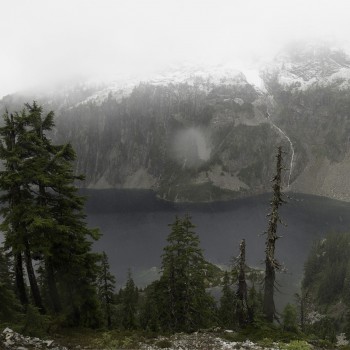
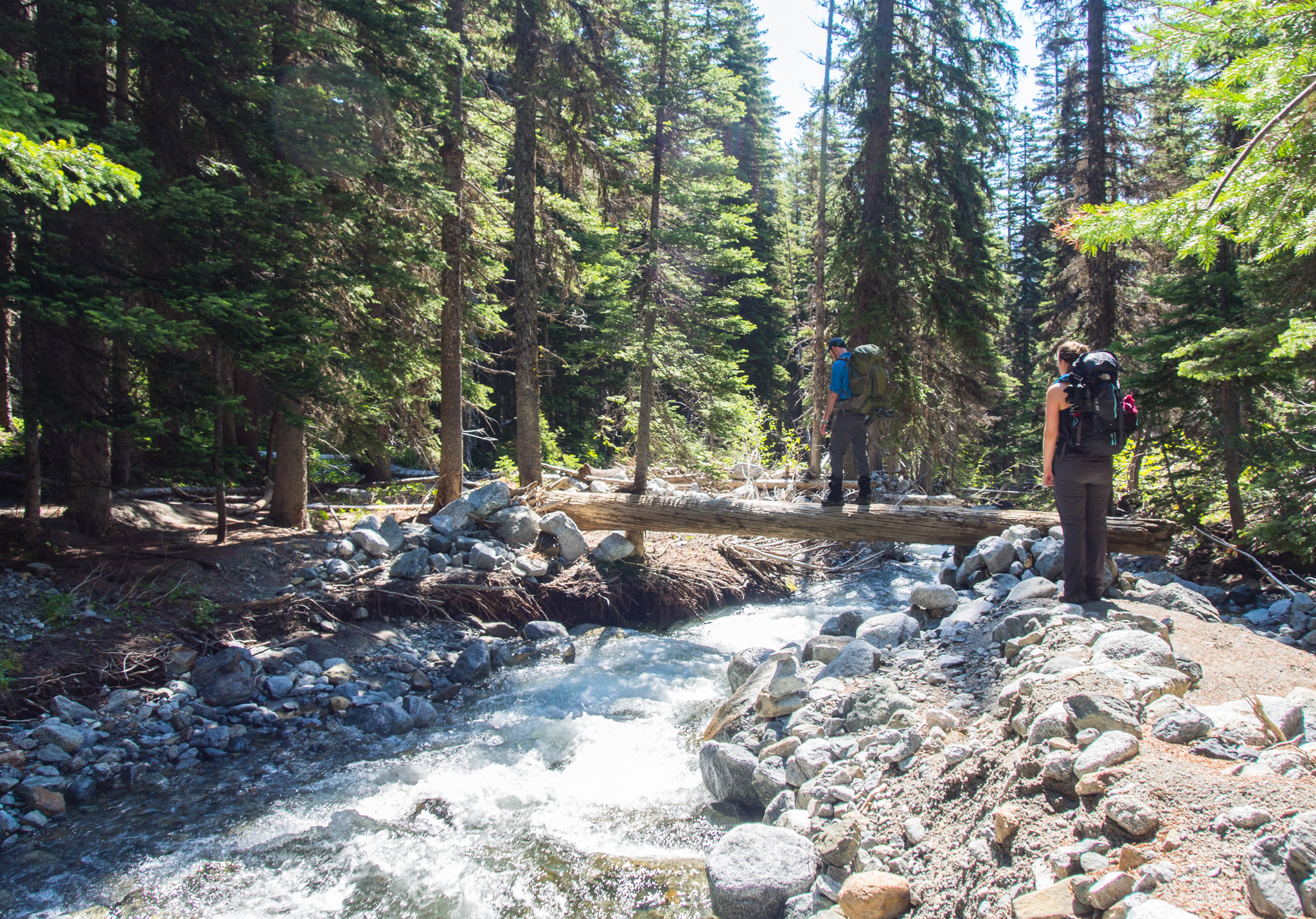
About a mile after leaving our angry goat friends and a loss of 1300 feet we were at the bridge that crosses Ingalls Creek. We stopped again to rest our legs and fuel up with some snacks. There are a few campsite in this area where climbers typically stay prior to climbing Mount Stuart. All I could think sitting there looking up at the huge mountain was how thankful I was that I didn’t have to climb all the way up it!
View of Longs Pass (low point of ridge in right half of photo) from near Ingalls Creek
Bridge across Ingalls Creek
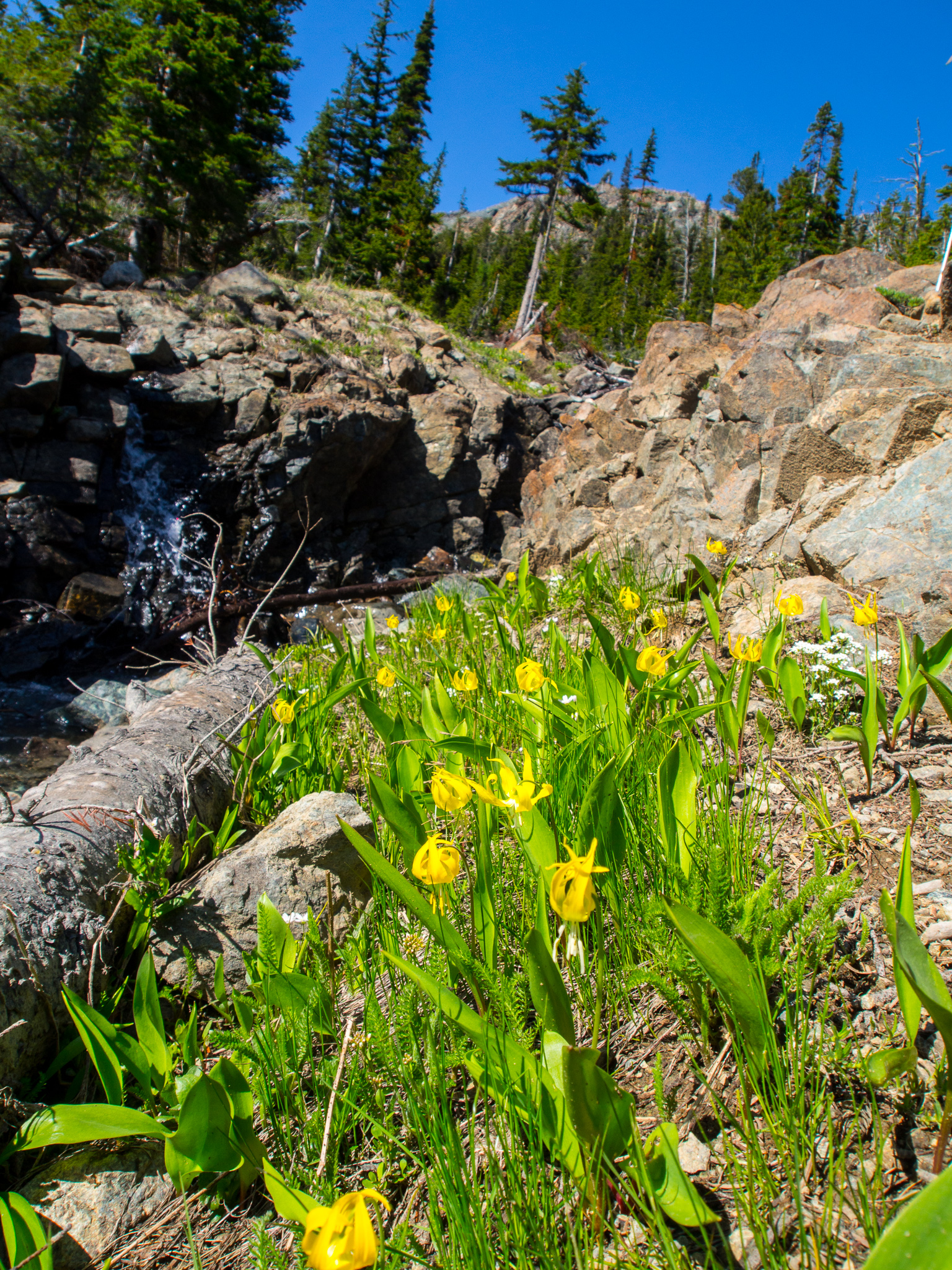
Glacier Lilies were in bloom
From the bridge across the creek we wandered up the trail towards Ingalls Lake. This part of the trail also required some route-finding skills as the trail is frequently interrupted by large boulder fields from the avalanche chutes descending Mount Stuart. We usually could find our way by cairns but sometimes it took a little hunting to find them.
Jesse and Kelly navigating a bouldery creek that descends Mount Stewart
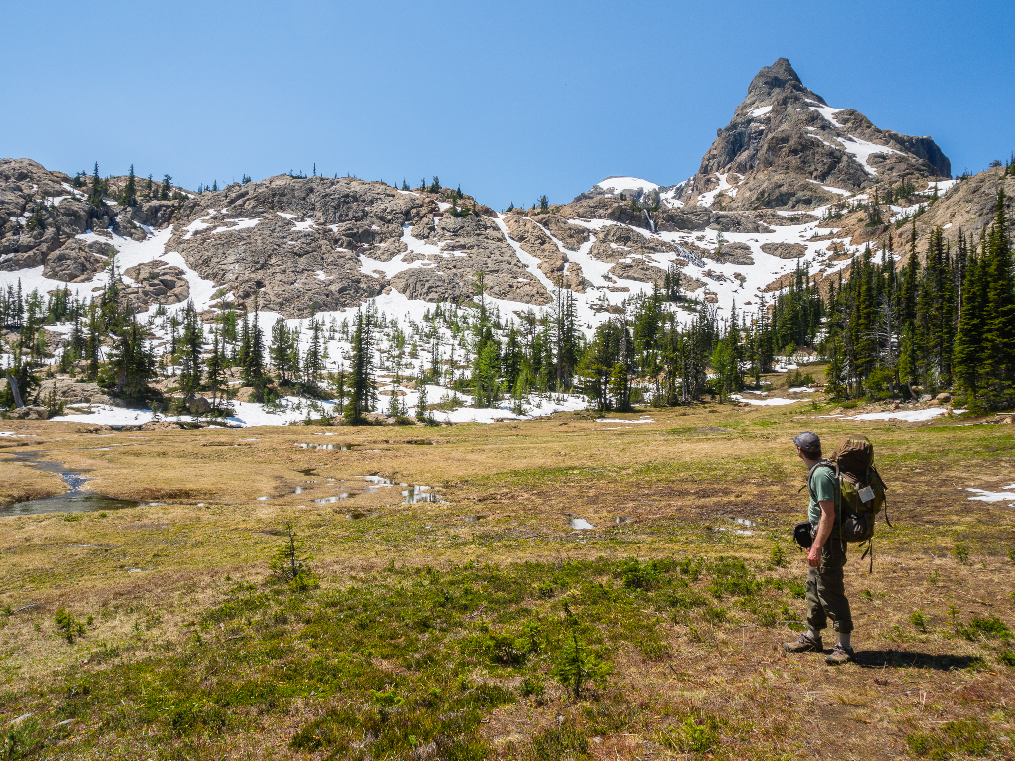
Our 6-mile day came to an end when we reached a wide, open meadow below Ingalls Peak and the cliffs protecting Ingalls Lake. The entire day on the trail we encountered only one other person about 2 miles in. From there we had everything to ourselves–including this gorgeous meadow in the perfect setting. I’ll go so far as to say this was one of the best campsite I’ve ever slept in. We found the perfect spots for our tents on a rock outcropping with views of Mount Stuart to one side and Ingalls Peak to the other. Don’t forget that camping is not allowed within a half mile of the lake.
Nothing to complain about here!
Kelly ascending the back way to Lake Ingalls
Can you spot Kelly down on that rock outcrop?
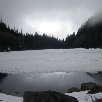
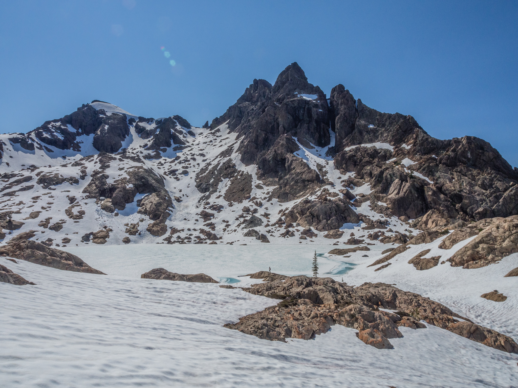
After a nap we scrambled across the rocky cliffs around us and eventually made our way cross-country to Ingalls Lake. The lake is still snow-covered, but it’s just starting to melt out leaving gorgeous blue puddles of melt water. After descending back to our campsite Jesse cooked up some delicious dinner that he had dehydrated at home along with some mushrooms he had foraged. It’s always nice to camp with people who are awesome chefs! Post dinner, Kelly and I decided we hadn’t had enough mileage for the day and we hiked up to Stuart Pass for some twilight photography.
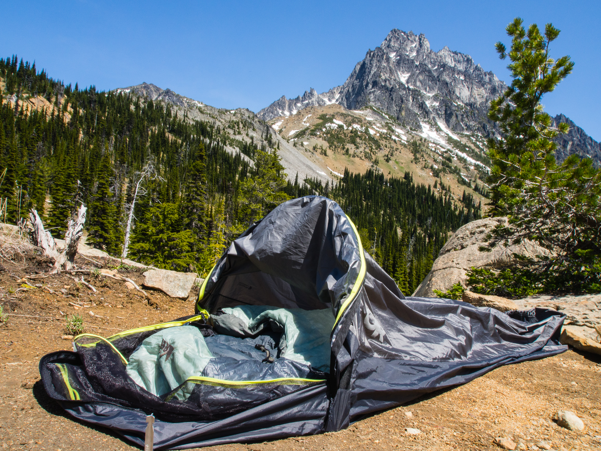
Bivy, meet Mount Stewart
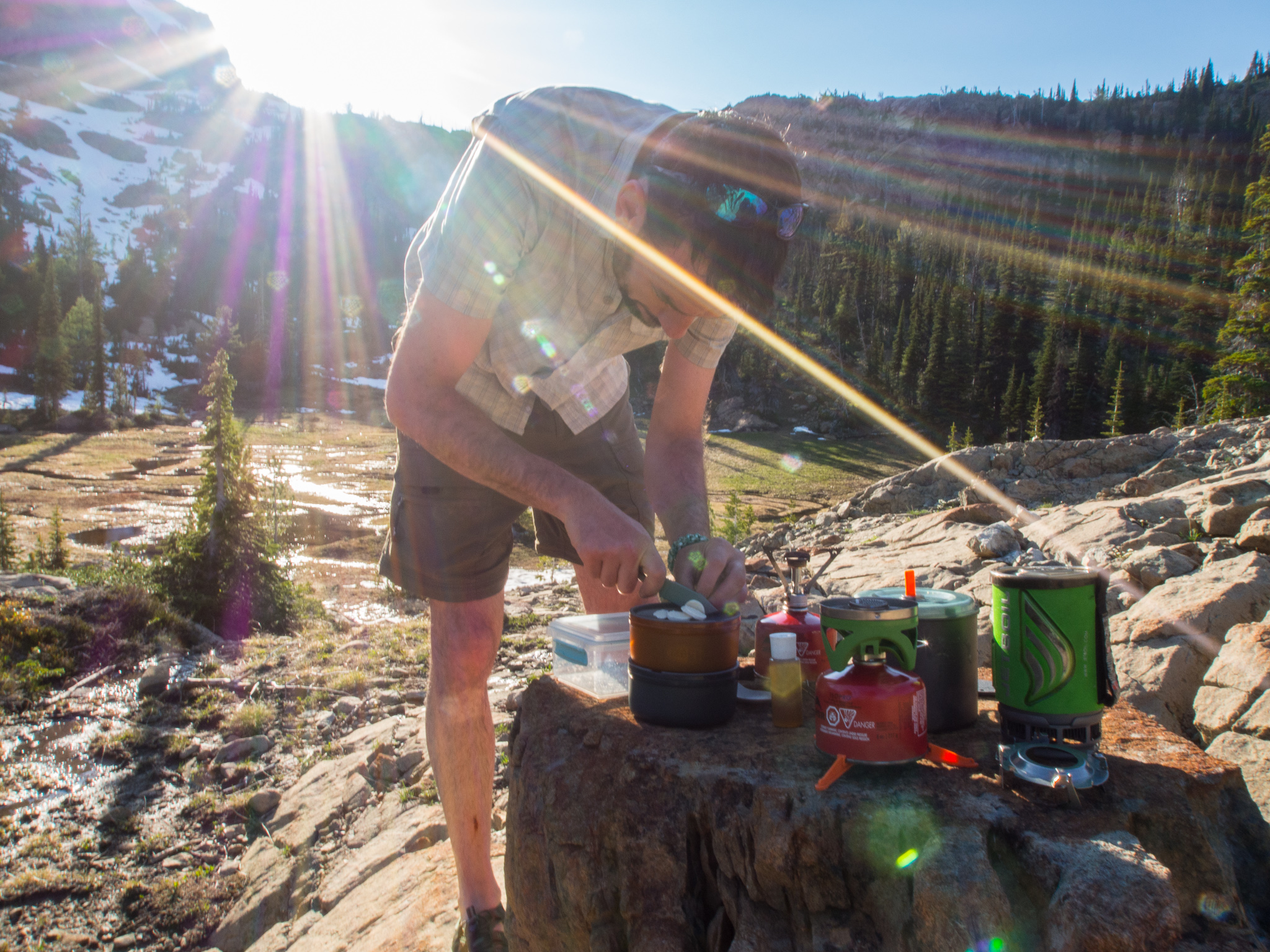
Jesse cuts up a foraged puffball for dinner

View from my bivy
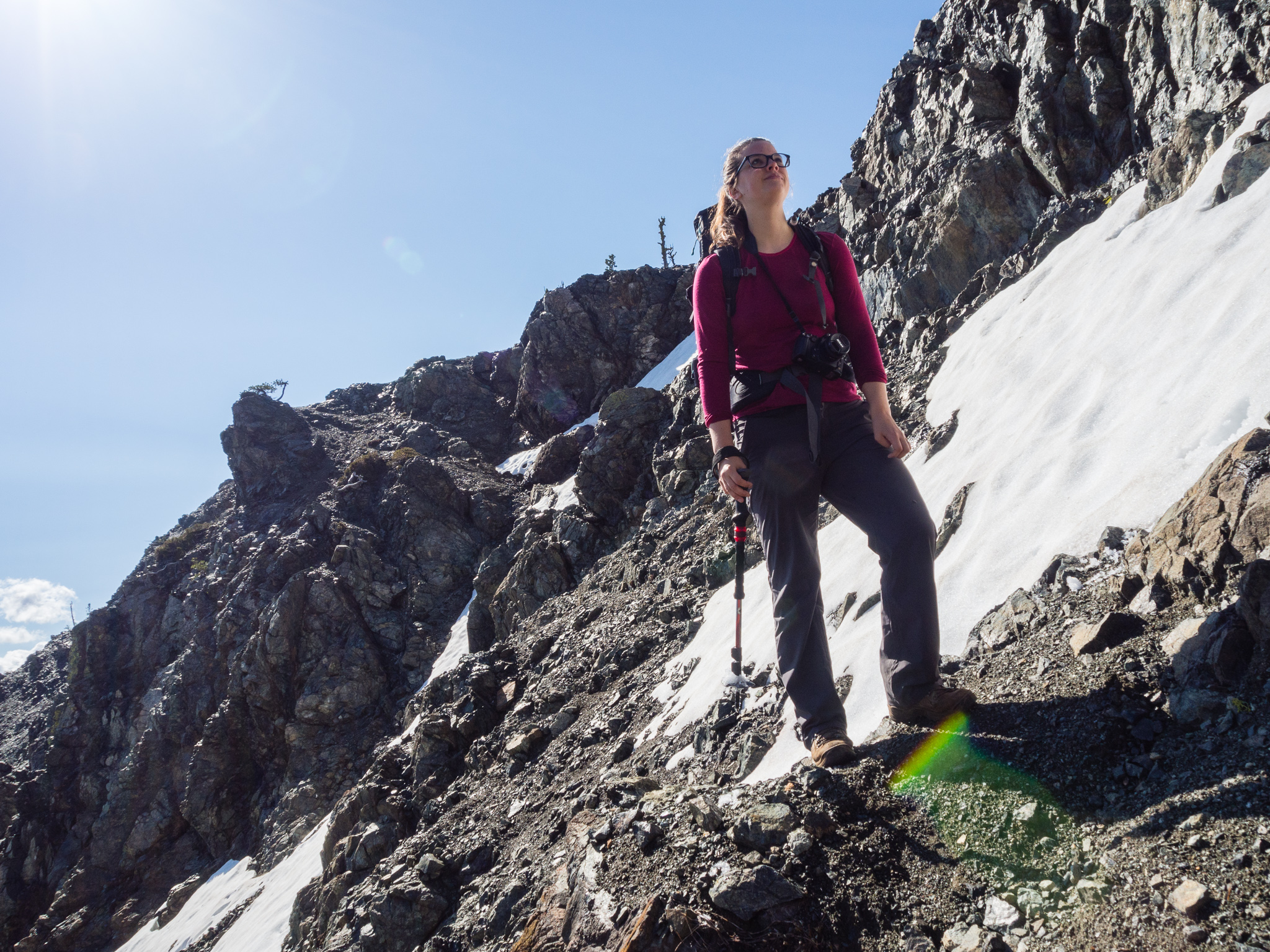
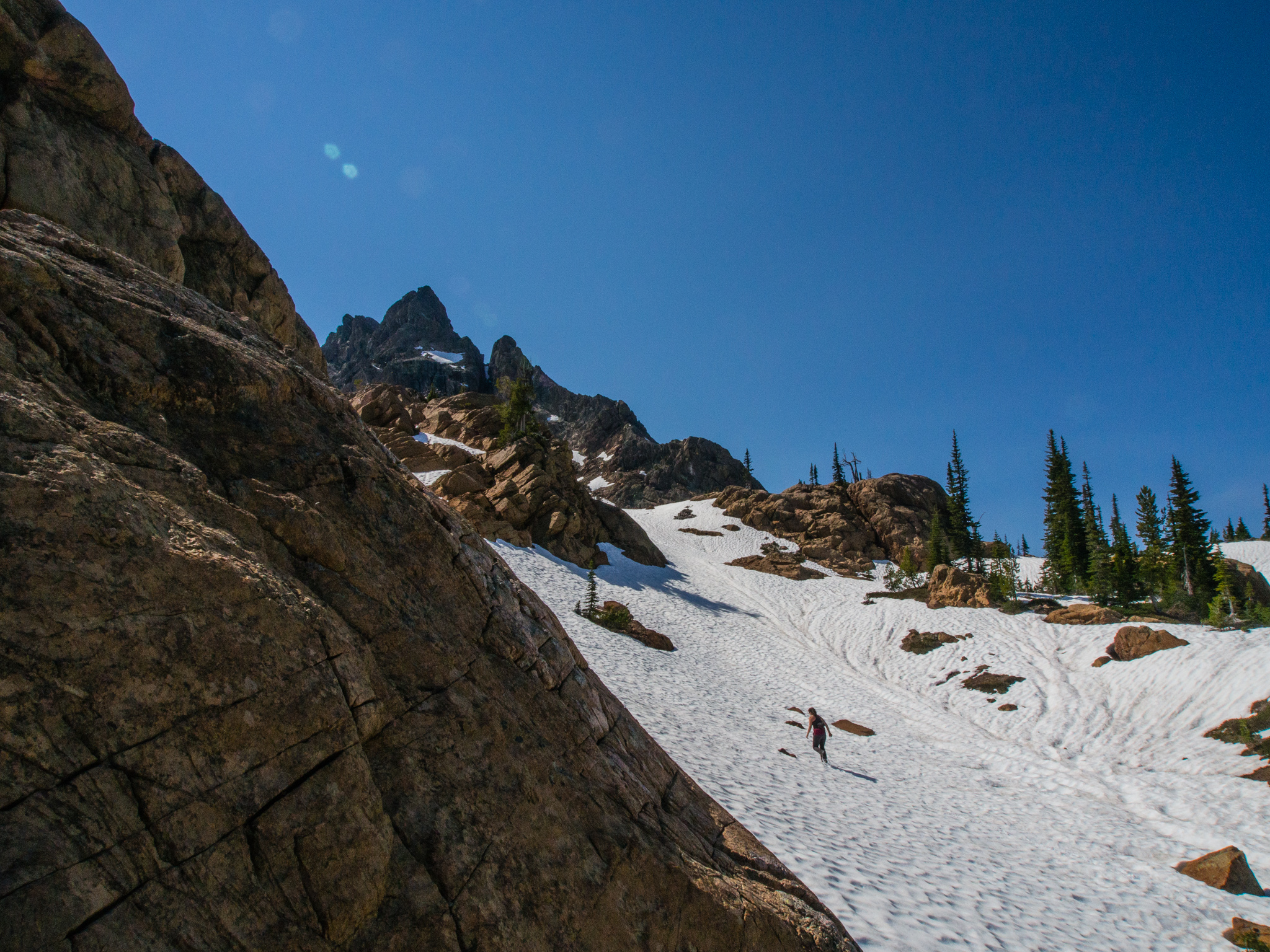
The next morning we didn’t get up until 10am. I guess we were a little exhausted! This was a special treat for me considering Jack wakes me up at home at ~6am every morning. Sleeping in my bivy made the night even more special as whenever I woke up I had an amazing view right there without a tent over me. After a leisurely breakfast we were back on the trail headed towards Ingalls Lake. This time we stuck to the official trail–which was more of a goat path than a trail. Again cairns led the way, although this time they were harder to discern. The fork towards Ingalls Lake was especially hard to find and again our GPS was super helpful to avoid going back to Stuart Pass where Kelly and I had taken photos the night before.
Those goats know how to route a trail!
Once back at Ingalls Lake we started climbing up the rocks thinking they would lead us around the lake while avoiding the steep, snowy slopes around the lake. We were also following someone else’s footprints so we figured they knew where they were going! But we soon found ourselves cliffed out without a good way to get down. Perhaps we could’ve scrambled down a crack, but with our packs on it would’ve been dangerous. So we backtracked down to the lake and made our way around.
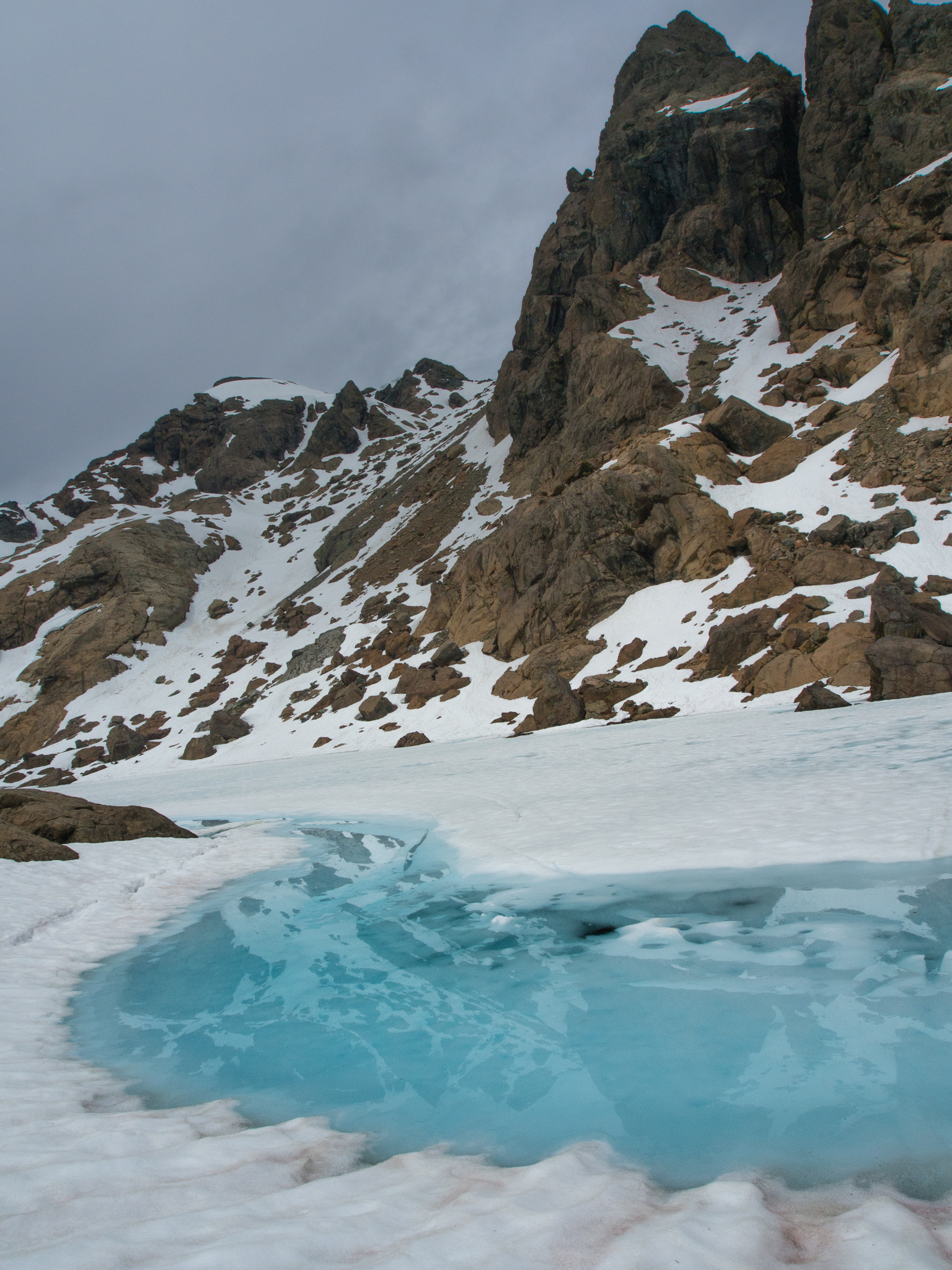
Meltwater on the lake
Great view, but how do we get down?
By this point the sun had heated up the snow and we were kicking off some pinwheels which was making me nervous about causing a wet loose avalanche. Sliding uncontrollably into a half-thawed alpine lake did not sound like a good way to start my week in Washington! Moving quickly, we soon found ourselves against another rock band where I realized that I was standing on top of a snow bridge. I transitioned onto the rock between the snow and warned Jesse and Kelly so that no one would plunge through. It wasn’t that big of a snow bridge so we probably would’ve been fine, but why risk it? After bypassing the snow bridge there was one last section of exposed snow to navigate before back on solid, safe ground so we moved quickly. Now at the other end of the lake we checked our map again and realized we had to descend a good ways to get back to the main trail.

Teamwork was utilized to bypass the snow bridge!
Glad to have all that behind us

More goats!
We had two options for the way back to the trailhead from the lake. There’s a higher trail that adds a third of a mile more of distance and a lower trail that’s more direct but dips down in elevation and then rises again. Thinking that we’d had enough snow shenanigans for a day we took the lower route. For the first couple hundred feet we were following someone else’s footsteps but suddenly they ended and the trail was hard to discern through the snow. Turns out everyone else has been taking the high trail! We bushwacked through snowy terrain and attempted to follow the general course of the route via our GPS and eventually ended up at the base of a moderately steep, snowy incline. After ascending this last snow slope we were at the top of Ingalls Pass and again Mount Rainier dominated the skyline.
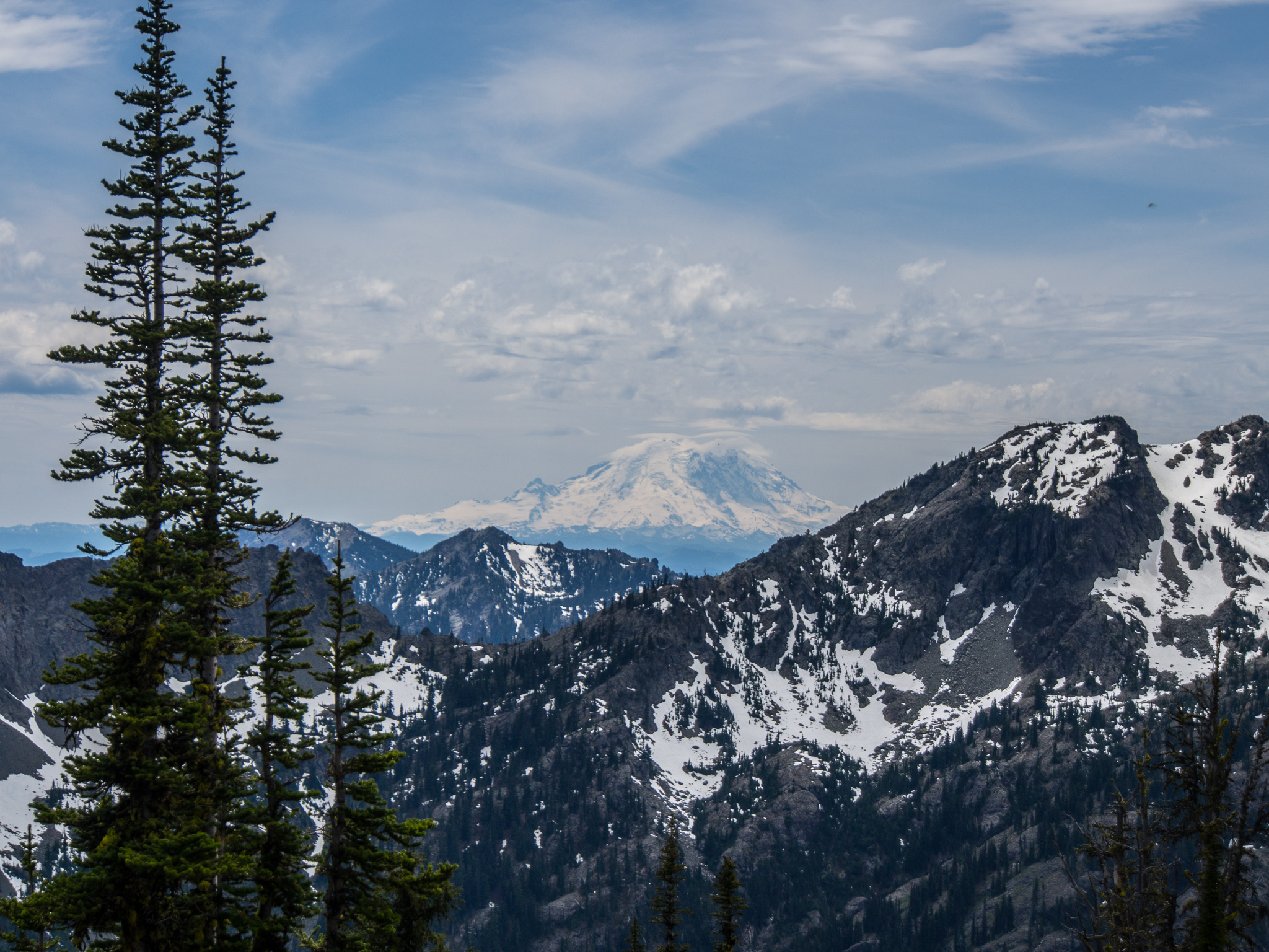
Never get sick of seeing that mountain
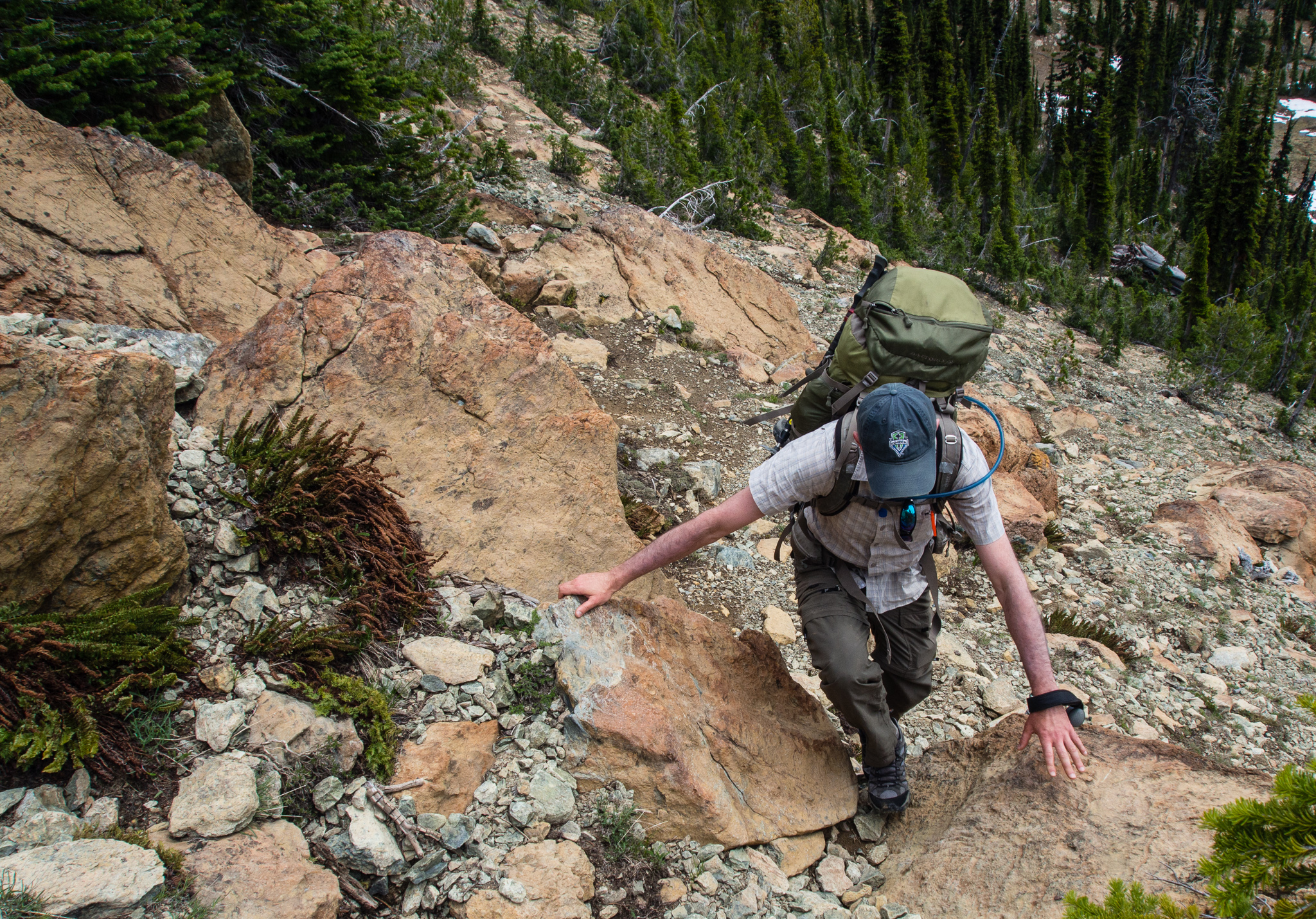
The way down from the pass was rather uneventful. We passed a lot of people which felt strange considering how few people we saw throughout the morning and the day before. Most of the people we passed were just wearing tennis shoes which made me wonder how cold their feet were going to be going across all of that snow! I felt the Longs Pass trail was a lot more secure than the Ingalls Lake trail, too. There were frequent sections where the trail was narrowly perched on a rocky slope. After a misstep made me slide down the slope a bit I decided I should be paying more attention to my feet than my camera.

An example of why you should pay attention to where you’re walking
Back at the trailhead we found twice as many cars than had been there when we left the day before. After packing up the car we headed to Cle Elum for some delicious Mexican food at Los Cabos!
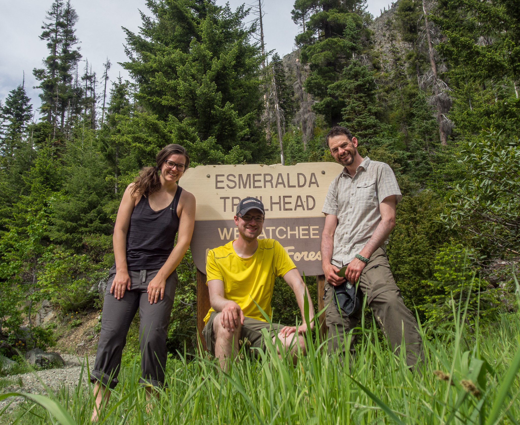
Thanks adventure friends!
This hike is definitely near the top of my list of all time favorite hikes. I can’t wait to bring Maura and Jack on it. The solitude we experienced was a pleasant surprise especially after seeing trip reports about the hordes in the Enchantments just on the other side of Dragontail Peak from us. If you do this loop be sure to bring a good map along to help you find your way since the trail disappears frequently.