I was back in Washington for a week for work and was able to get our friends Marie, Wendy, and Jesse together for a weekend trip. My flight didn’t get in until Saturday morning so we made a plan for Jesse and Wendy to pick up permits Friday evening and then Marie and I would meet them at the backcountry campsite on Saturday. I really had my heart set on getting a permit for Cascade Pass and camping at Sahale Arm or Horeshoe Basin, but those permits were all gone by the time Jesse and Wendy got to the ranger station in Marblemount (permits are available 24 hours in advance of your trip and required for overnight stays). They did, however, manage to get permits for a campsite at Thornton Lake.
From the airport, Marie and I made the drive to the trailhead with only two pitstops – one to drop her dog, Beth, off at our friend’s place (dogs aren’t allowed in National Parks) and another for some pre-trail Subway. The trailhead was full so we had to park along the road and walk a little ways, but it wasn’t too far. Despite all of the cars we didn’t see that many people on the trail.
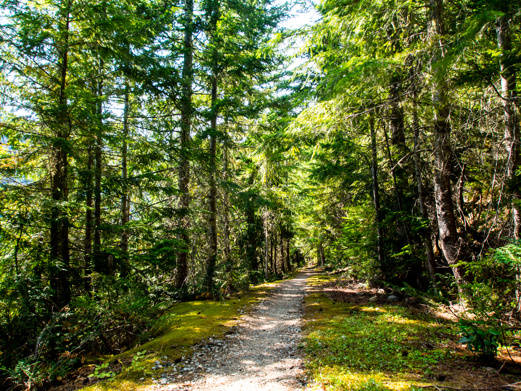
Old logging road
The trail begins on a decommissioned logging road that nature is slowly taking back. This part of the trail is really flat and easy so you can crank out the miles. There are a few sections where the bushes are trying to take the trail back and due to recent rains made our pants pretty wet.
Bridge over Thornton Creek
At 1.16 miles we crossed a sturdy log bridge over Thornton Creek. It was pretty hot out and we took note that the creek had some good swimming holes to take advantage of on our hike out on Sunday. Remnants of an old, not so sturdy bridge can also be seen in the debris in the creek.

Thornton Creek
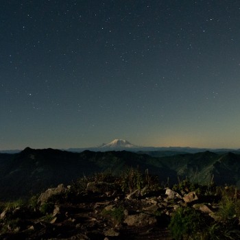
After the creek, the trail continues to follow the old forest road. There were a couple of small sink holes which were cool to look at, but other than that this part of the trail is pretty non-descript. I was ready for some views! Every once and a while you could see through the trees to some of the glacier-clad peaks across the valley, but I must admit, I found myself day dreaming about what the hike to Cascade Pass would’ve been like.
At a little over 2 miles from the trailhead, the trail left the forest road and started to get more interesting. As the trail steepened, the forest began getting more ancient as we left the areas that had been logged along the road in the 1960s.
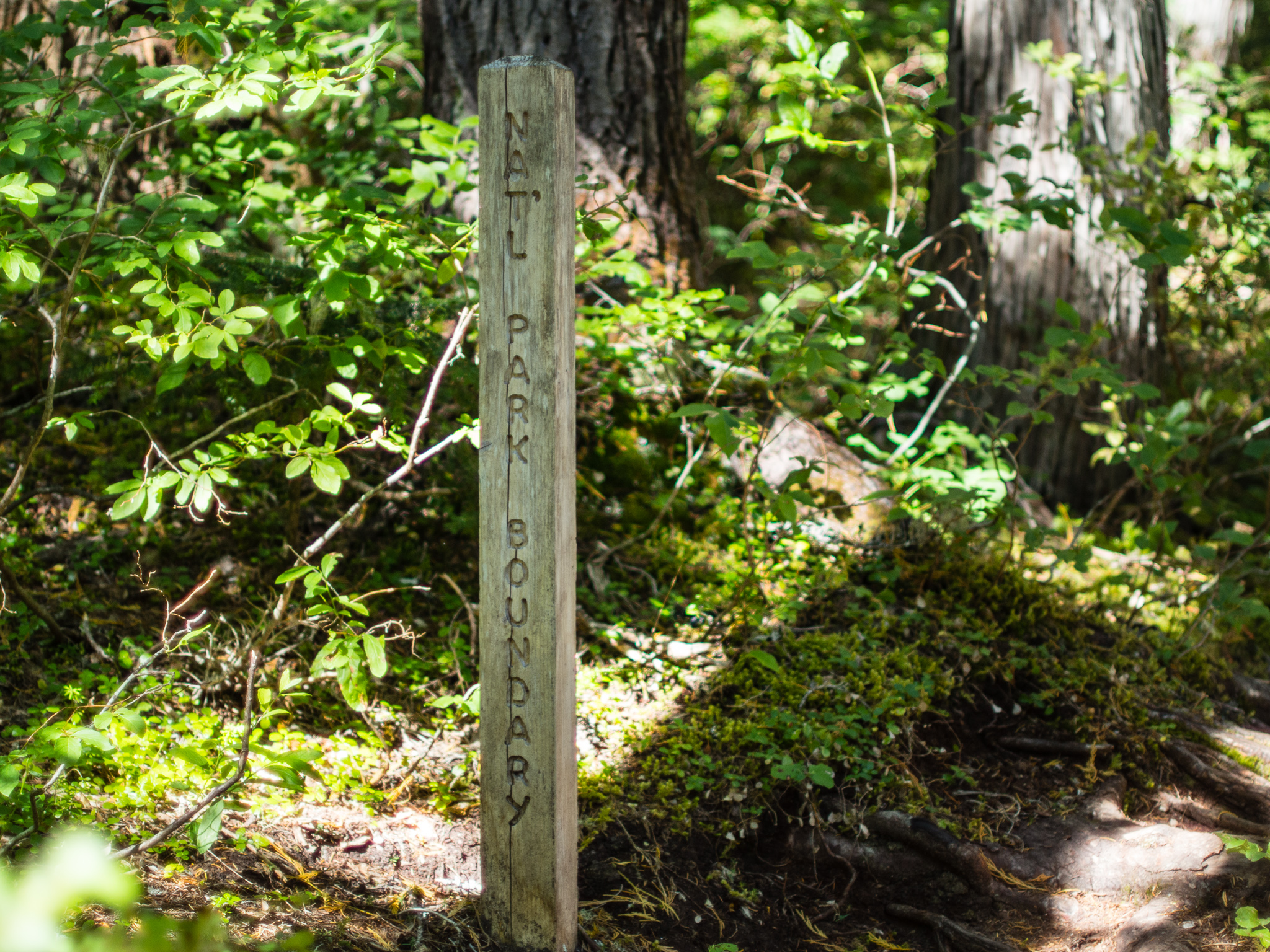
Entering North Cascades National Park
3.5 miles in we entered North Cascades National Park. I’m well known for my poor distance estimation skills and I insisted to Marie that we were nearly to the ridge where we’d start descending to the lake. But, as we continued upwards and began passing switchback after switchback I realized I was wrong. In reality, we still had almost a mile left until we’d get to the ridge and have any sort of view.
We crossed paths with a very nice NPS ranger who we chatted with for a bit. He asked us where we were headed and we told him we were meeting our friends who had our permit. He mentioned that they had set up their tent in an improper location and that when we set up our tents we should make sure they’re in a designated campsite! All of us take pride in following the rules in our parks and wilderness areas so I had a good chuckle that Jesse had messed up. Later I learned he had found an amazing site overlooking the lake, but it was closed for restoration. Poor signage made it so this wasn’t apparent, usually there’s a little ‘area closed for restoration’ sign to make it clear. So if you’re camping by the lakes, make sure you camp in an area explicitly labeled as a campsite – there are 3 of them.

Trail junction at ridge. Heading left takes you to Thornton Lake (note it’s misspelled on the sign). Heading straight takes you to Trappers Peak.
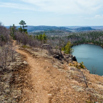
Finally, at 4.3 miles in we reached the trail junction at the ridge. After some snacks we headed toward the lakes to meet up with Jesse and Wendy. From the trail junction the path starts to really open up and you begin to get amazing views of the surrounding peaks. This is just a teaser of what was in store for us the next day when we scrambled up Trappers Peak.

Marie and Thornton Lake
From the ridge we quickly descended about 600 feet in a little over a half mile. The entire time we were surrounded by huckleberries. The number of berries was overwhelming! And they were so delicious. By the end of the trip Jesse’s face was permanently stained blue. It’s a good thing it wasn’t too cold or we would’ve assumed he had hypothermia from his blue lips!
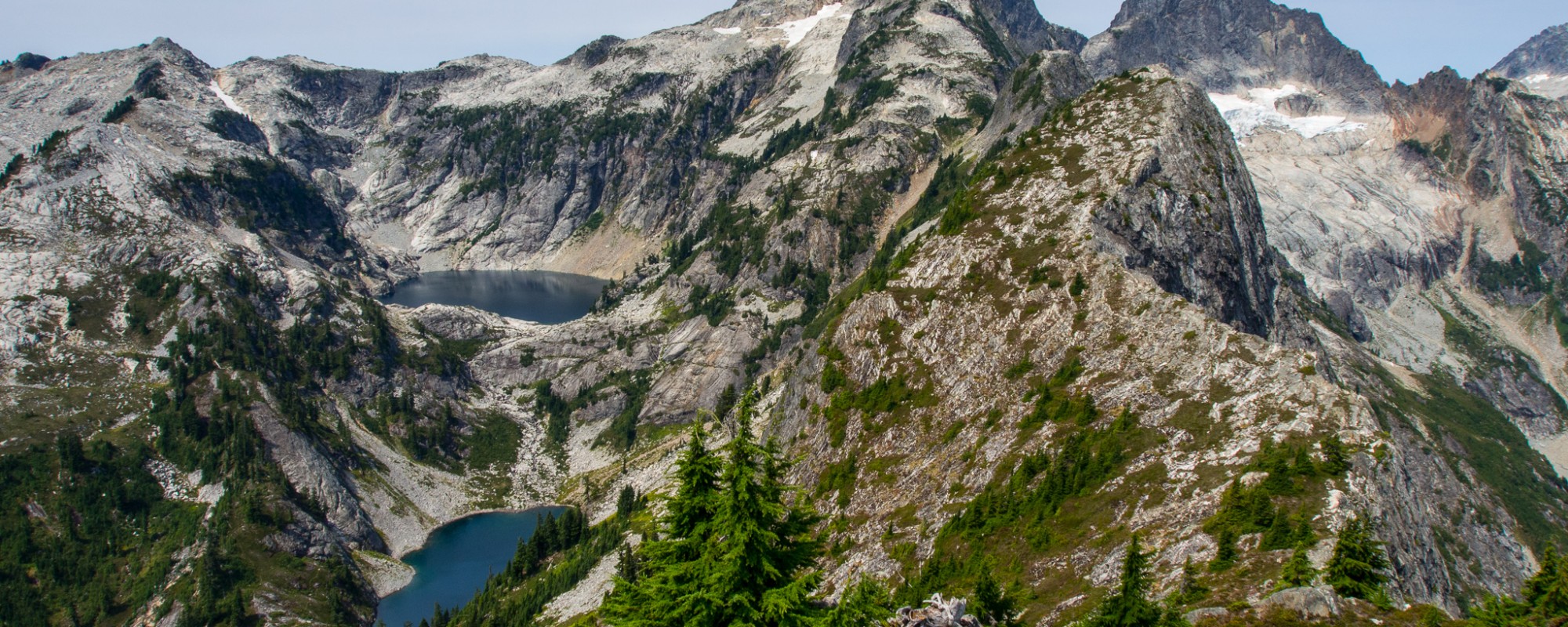
I couldn’t stop snapping pictures the entire way down to the lake. There are actually three lakes, we could only really see the first one from this part of the trail. Behind the lakes stands Mount Triumph with a glacier pouring out of it (some of which can be seen in the left side of the photo above). To the right of the lake is Trappers Peak which we’d summit the next day.

Wendy and Jesse waiting for us.
As we continued the steep descent to the ridge Wendy and Jesse came into view relaxing on some rocks near the lake. I was glad our plan had worked out and that we were all able to meet up even without a way to communicate with one another!

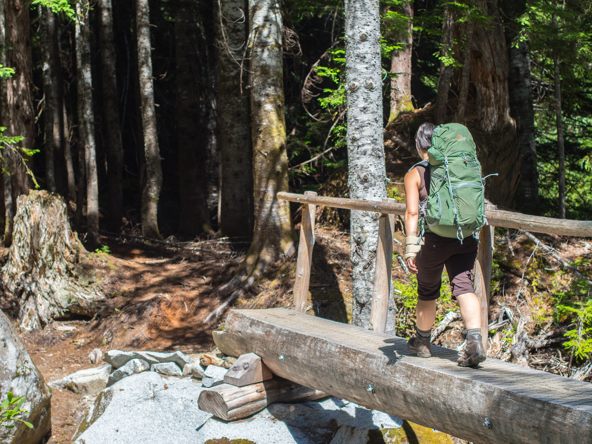
To access the camping area we descended some large boulders and crossed a log jam
Once at the lake we reached the log jam that I had read about prior to the trip. The NPS site mentions that it can be challenging to cross the logs. However, since we had such a poor snowpack last year the lake was really low and the log jam was easy to cross. In the picture above you can see the lines on the rocks of where the water used to be. It was almost dinner time once we got to the lake, and unfortunately it was too cold now for swimming. So we cooked along the rocks on the lake and then went to bed.
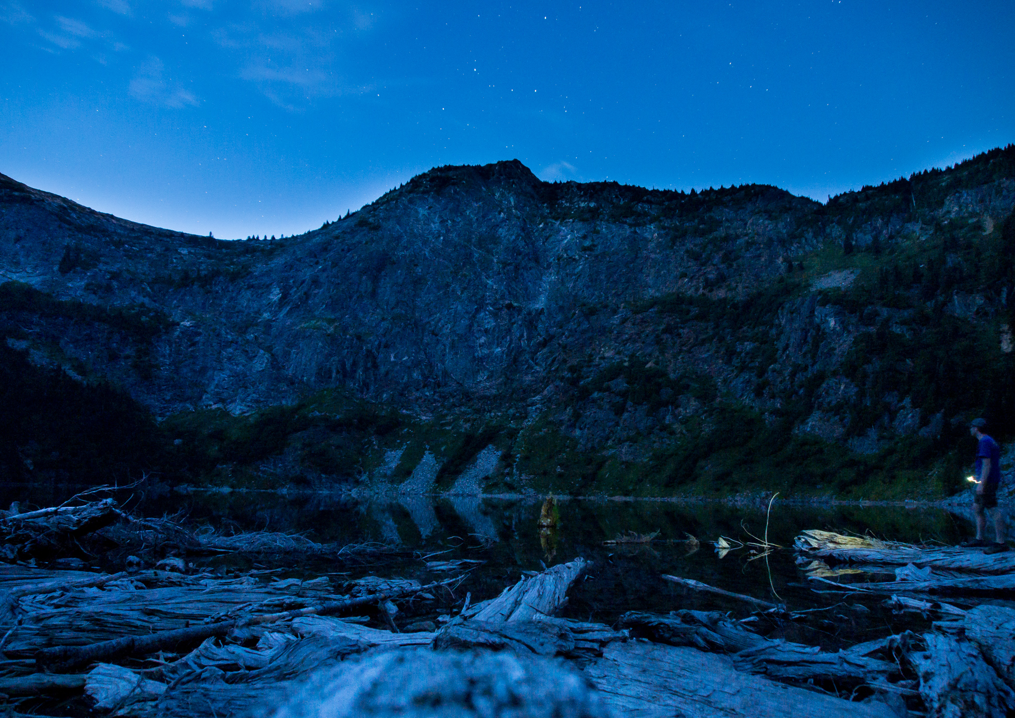
Self-portrait of me at dusk with the lake and Trappers Peak. I’m not sure how I didn’t fall in the water taking this.
Our campsite was just big enough for two tents and my bivy. Each of the three sites at the lake have a 4 person capacity and require bear canisters for food storage (you can rent them from the Marblemount ranger station if you don’t have one already). The composting toilet was a short, awkward, walk away. I say it was awkward because you have to pass through the other campsites to get to it. Our site was really nice because we were right next to the lake outlet and had a clear view down the creek valley. Also remember that no fires are allowed here any time of the year – it seemed like people were following that rule since there wasn’t a fire ring at the site.
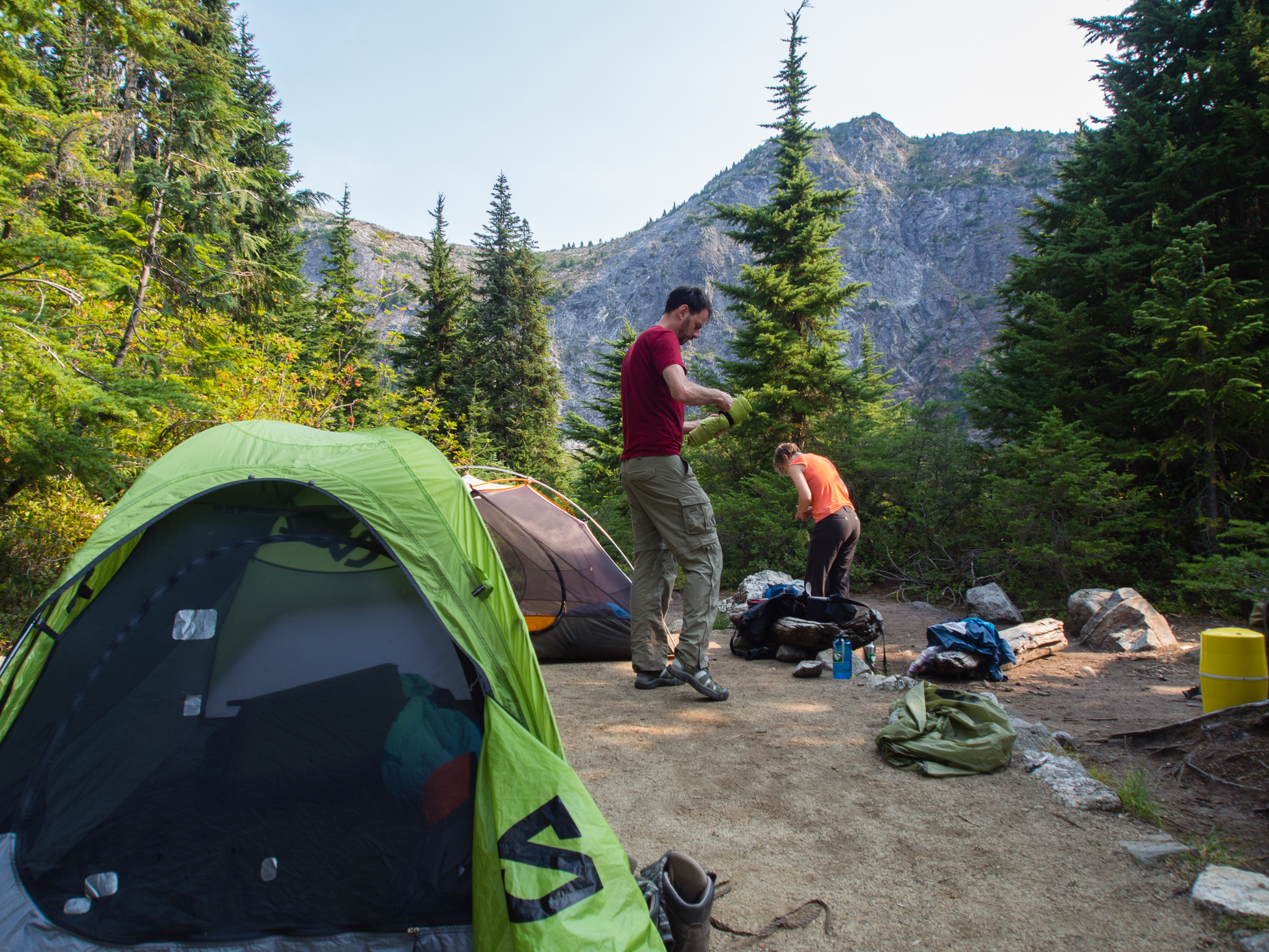
Wendy and Jesse breaking camp Sunday morning
The next morning we weren’t in a huge rush so we all slept in a bit and then ate a quick breakfast. After breaking camp we made our way back up the ridge to the junction with Trappers Peak. The hike back out to the ridge was slowed by the abundance of huckleberries around us.

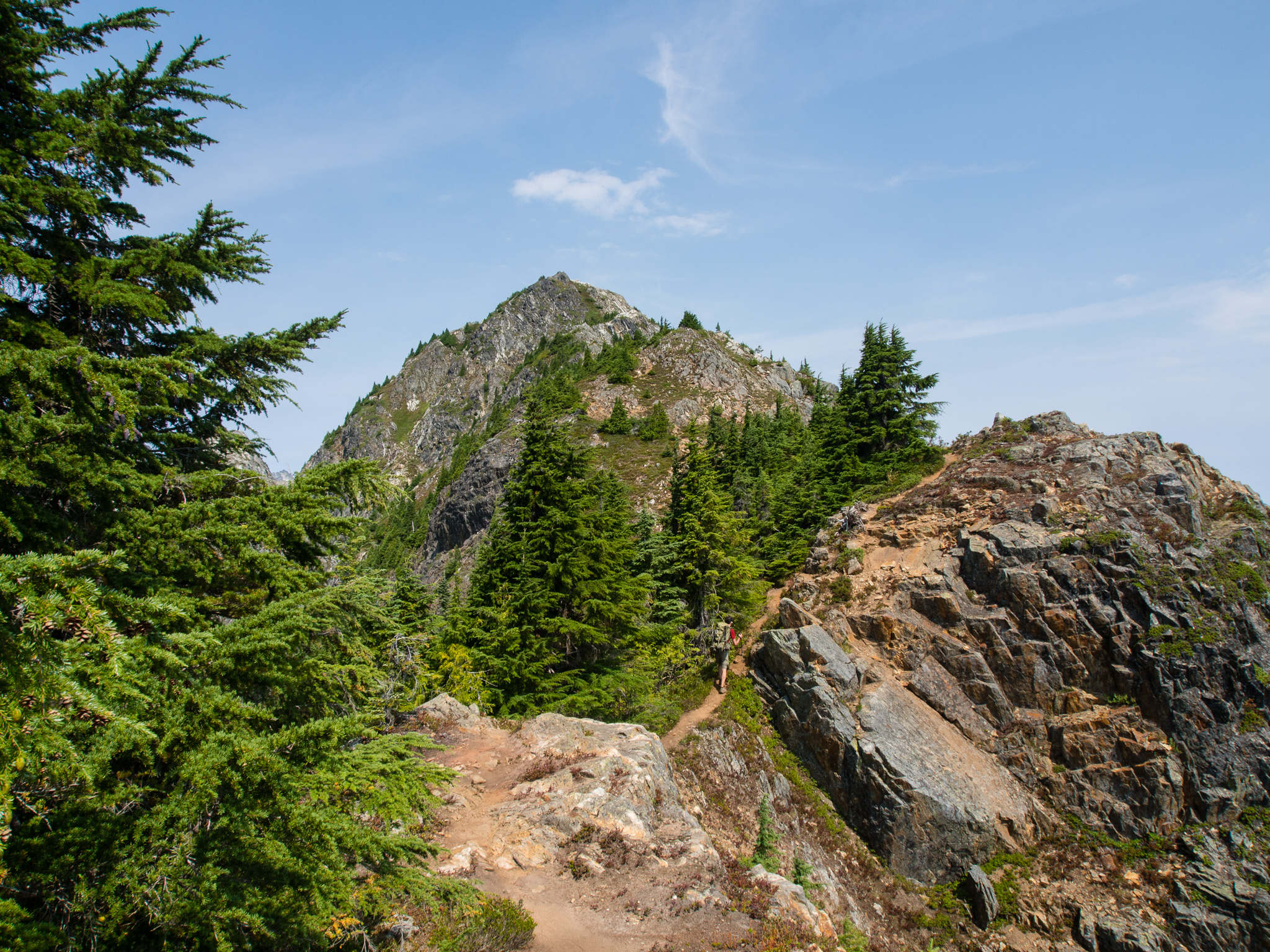
Beginning the hike up to Trappers Peak
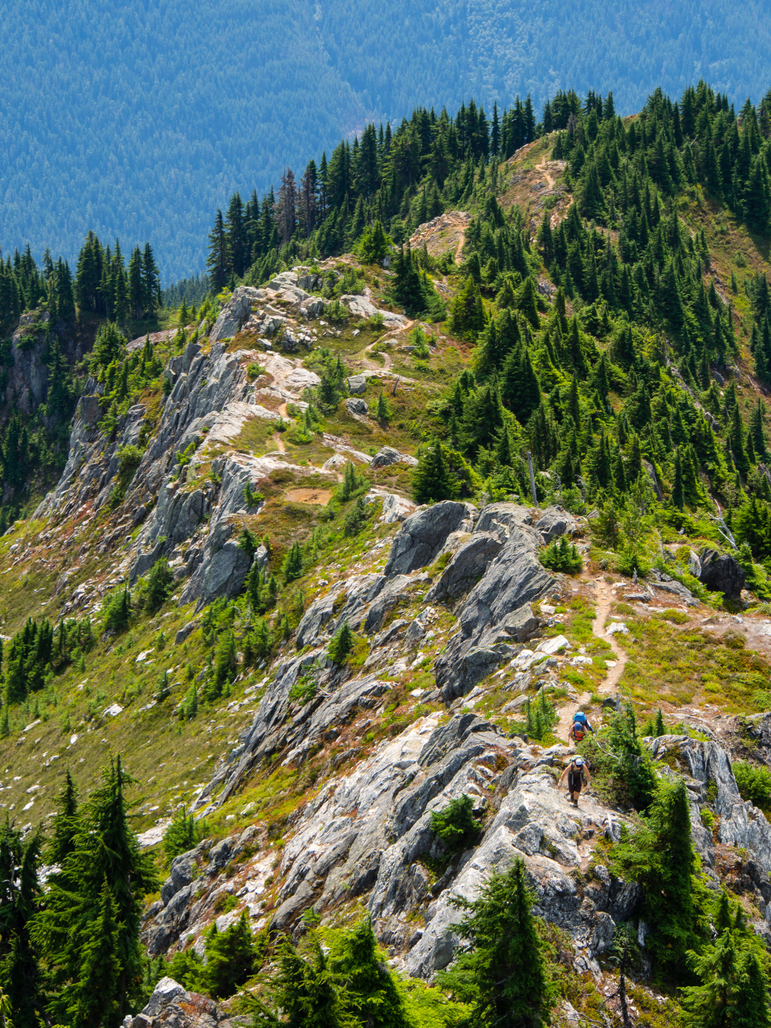
Wendy and Jesse were training for the Wonderland Trail so they wanted to carry their full packs up the peak. Marie and I have no such plans, so we had no problem stashing our gear in the trees at the trail junction. The trail up Trappers Peak begins with several social trails and at times it was difficult to tell which way we were supposed to go, but it seems all of the paths eventually converge. The way up to the peak is quite easy, with just a few steep sections. The crux of the climb comes early on when you have to scramble up a little rock gully. The most difficult part of that section for us was that a group of 4 was trying to come down at the same time as us and there isn’t any room for passing.
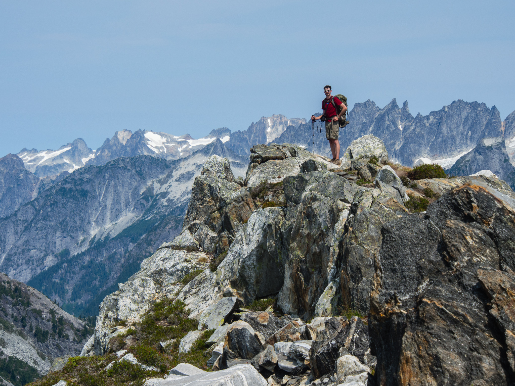
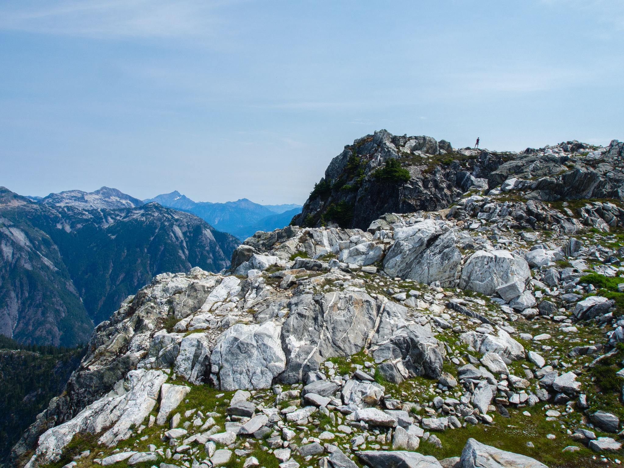
Trappers Peak in the distance
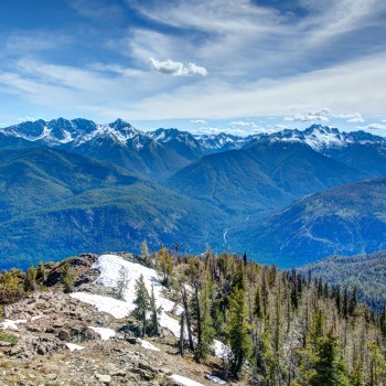
The hike up to Trappers Peak was definitely the highlight of the weekend for me. The views are jaw-dropping all around you and it was really fun to see the summit of the peak in front of us as we traversed the ridgeline. To our left the entire way up we could see our campsite over 1,000 feet below which gave me a real sense of accomplishment.
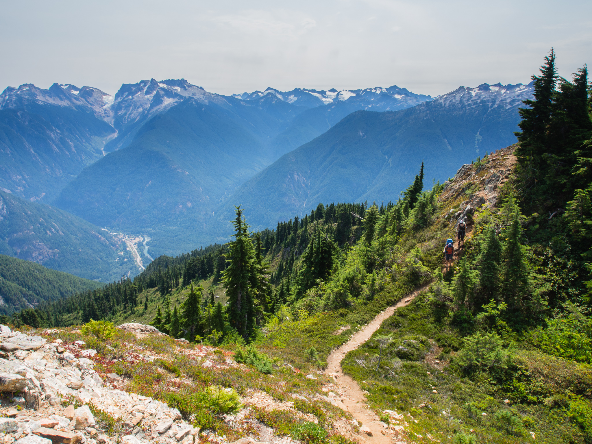
Wendy and Marie on the trail. To the left in the valley is the town of Newhalem
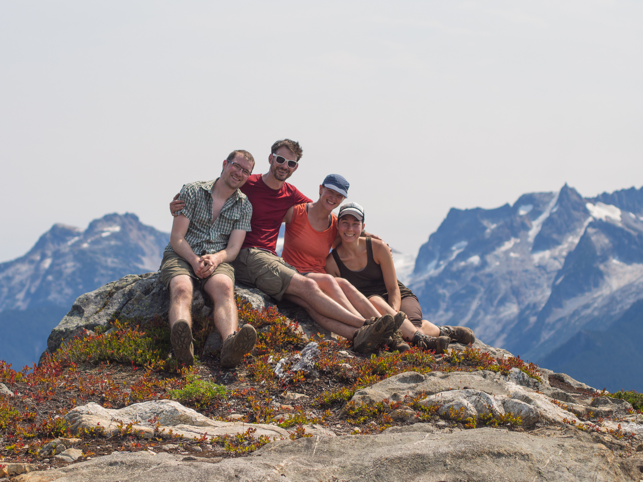
Group shot on the ridge

Jesse with our campsite visible at the mouth of the lake below
Marie and Wendy hiking up Trappers Peak
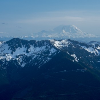
Seriously, I couldn’t have asked for a more photogenic trail to kick off my week back in Washington. From the top we could also see the peaks around Cascade Pass which was fun. Unfortunately, it was too hazy to see any of the volcanoes, but there were plenty of other beautiful mountains to gawk at.
Jesse on the summit with the Picket Range in the background
There are a number of false summits. Eventually, it becomes quite obvious where the summit is as you climb steeply up the last section of trail. The top of the mountain is really wide so Jesse and I wandered around a bit climbing to the top of each stack of rocks and asking one another who was taller. Eventually we found the summit, only to find it covered in tiny little gnats that wouldn’t leave us alone! After grabbing a shot of Jesse we retreated to a few feet away which had fewer flies. Careful, there’s a really steep drop off the backside of the summit!
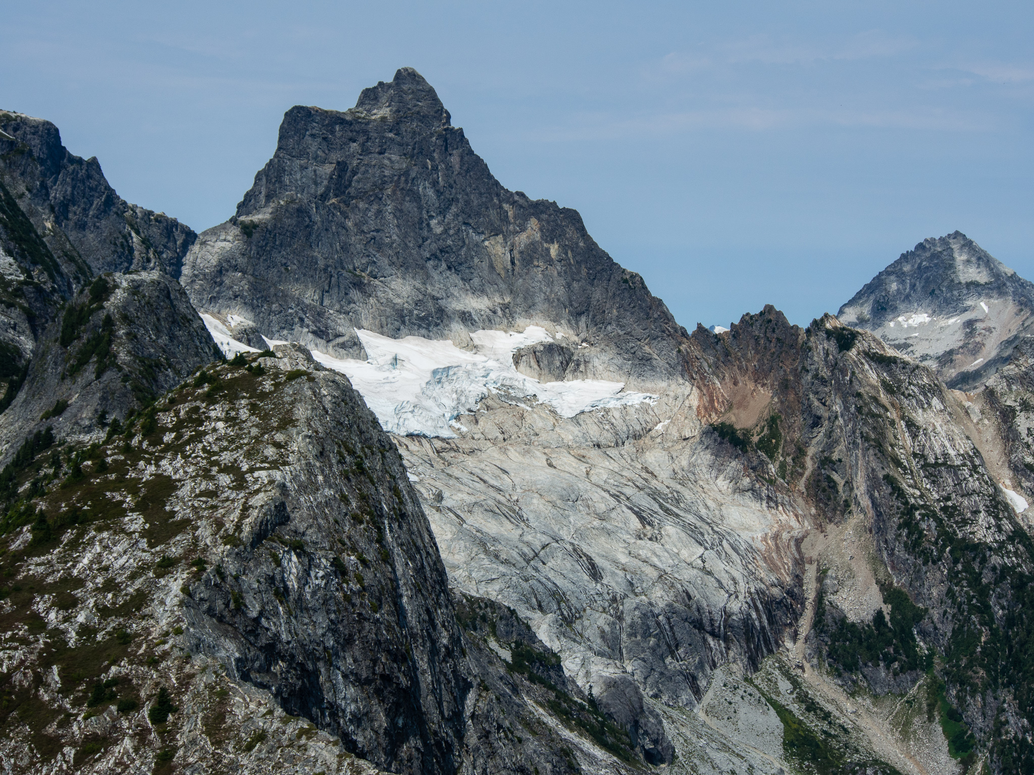
A glacier clinging onto granite below Mount Triumph
Looking back on Jesse near the summit
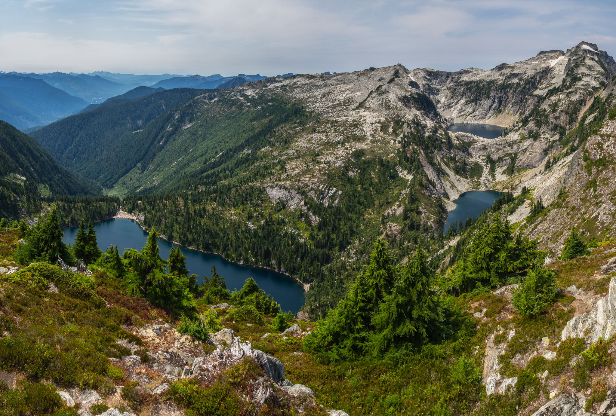
The three Thorton Lakes
From the summit you can see all three lakes below. In the morning we had met a couple who had climbed Mount Triumph the day before and they said they camped at the highest lake. If I ever come back here that’s definitely where I’d want to camp. Our campsite was nice, but I didn’t like being so close to two other groups. To camp at the third lake you need to obtain a permit to camp at the Triumph Col cross-country zone. No camping is allowed at the second lake.
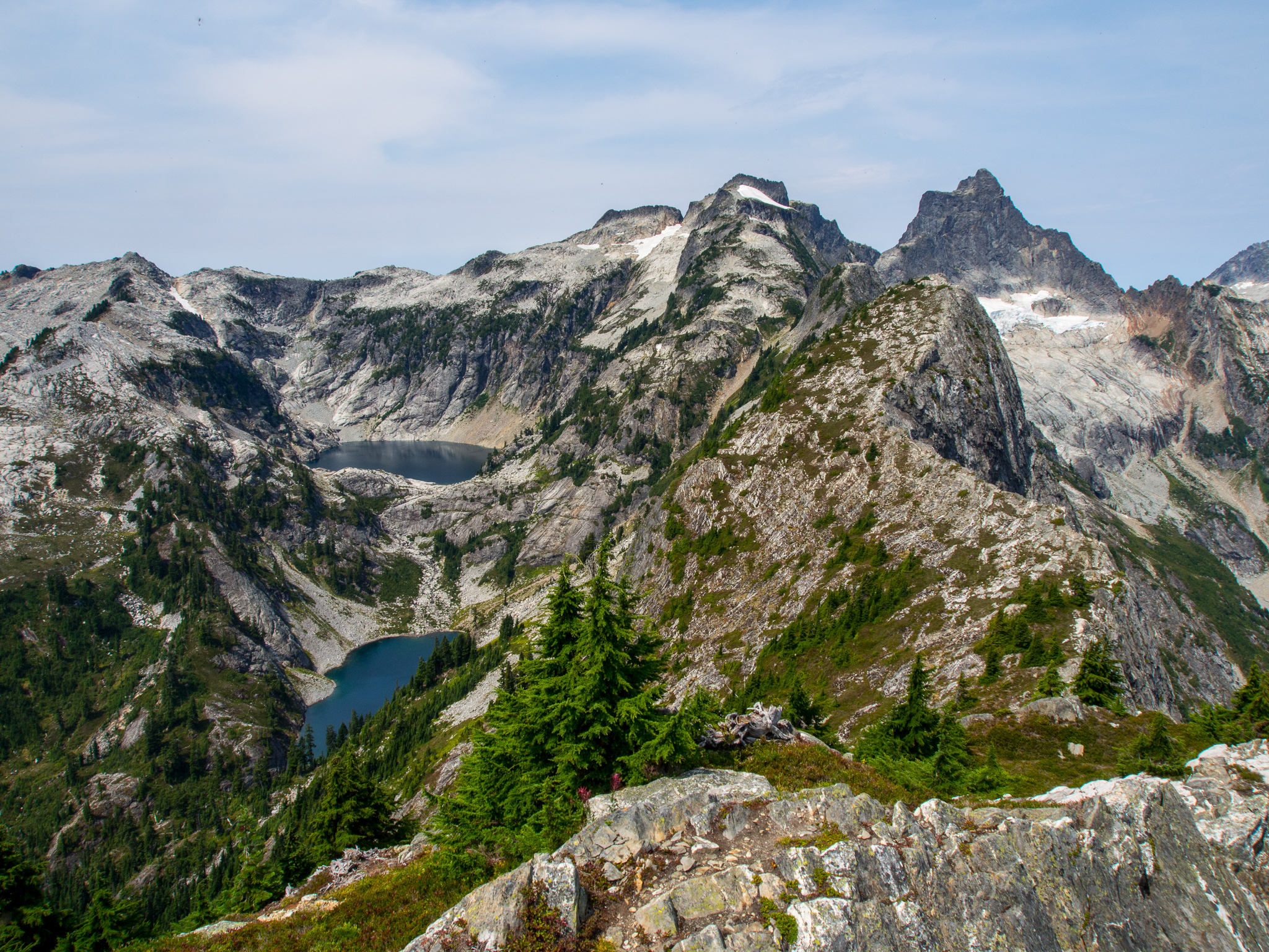
Mount Triumph and Thorton Lakes
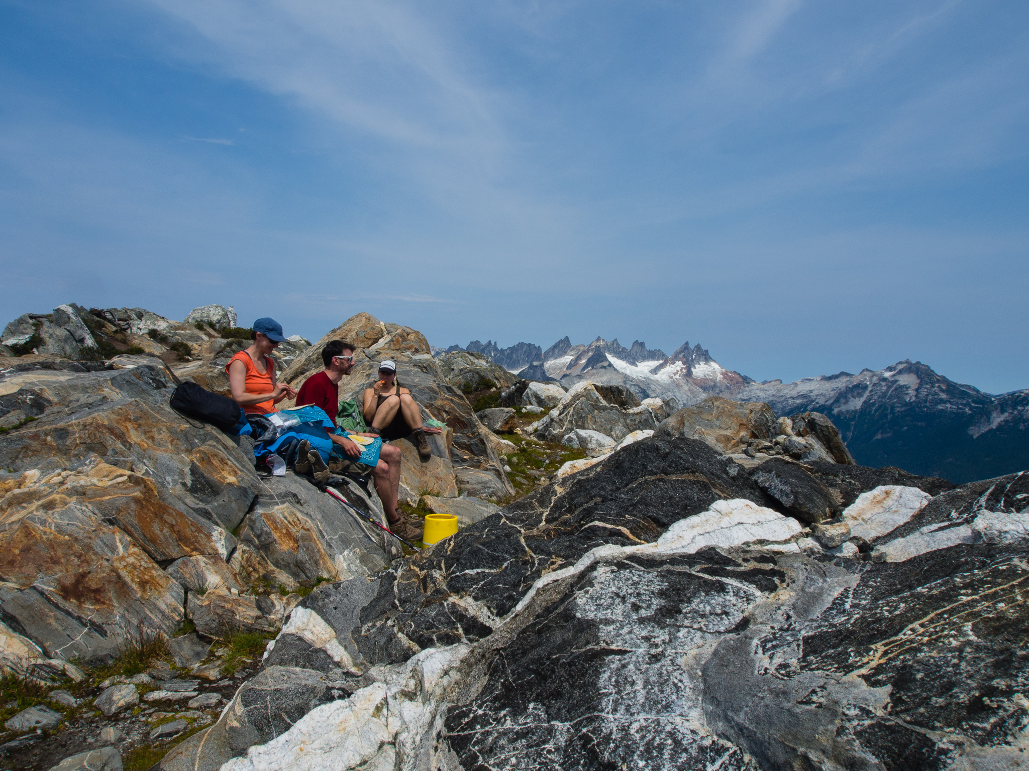
Lunch near the summit with the Picket Range behind us
We ate our lunches at the summit with beauty all around us. It was probably the longest I’ve ever lingered at a summit, I don’t think any of us wanted to leave. Plus, the breeze on top of the mountain helped calm the heat. Eventually we had to descend to get back into Seattle at a reasonable hour. The hike out went smoothly, but the last couple of miles on the forest road definitely dragged on. When we got to Thornton Creek we all jumped in to cool off before getting back to our cars and heading home. The water in the creek was a lot colder than the lake’s water was, I’m not sure how that works!
While I had my heart set on Cascade Pass, I’m thankful we were able to get a permit for this beautiful hike that I didn’t even know about before heading out. We hardly saw anyone and due to the permit system there were only two other groups camping at the lake which was nice. Since we did this as an overnight we had plenty of time to explore the lake and the mountain. If I were to day hike this trail I would skip the lake and just hit the summit due to the elevation you lose going down to the lake.
A weeks after our trip a number of fires raged through the North Cascades. The Goodell fire started on August 10 and was just a few miles east of where we hiked. In the map below you can see the fire’s perimeter in relation to the trail. The three W’s mark that the lakes could be used by helicopters for collecting water. Suffice it to say, the views back towards Newhalem will look different now than they did when we were there the week prior.
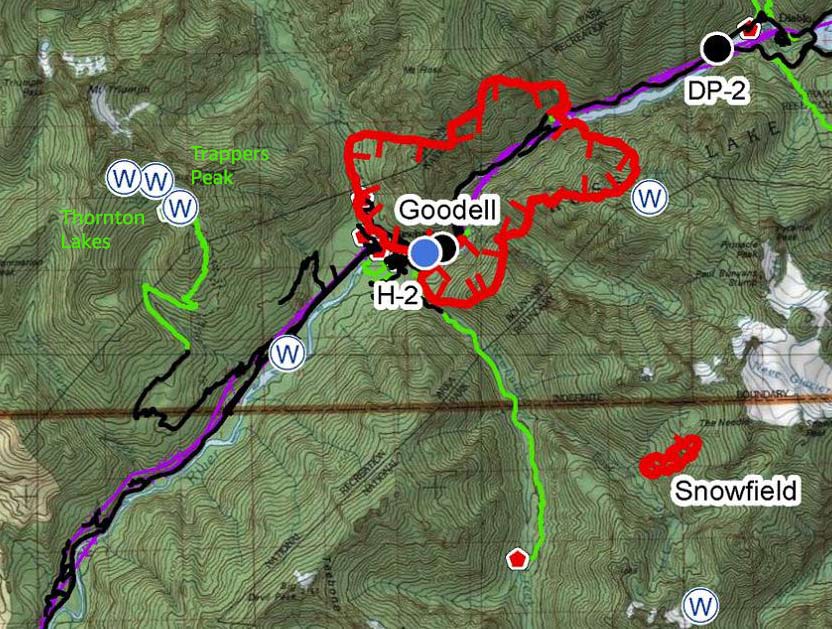
Map from Great Basin Incident Management
My GaiaGPS app on my iPhone measured it as .94 miles from the trail junction on the ridge to the summit of Trappers Peak with 1,306 feet of elevation gain one-way. It measured 4.93 miles to the lake from the trailhead with 3,106 feet of elevation gain and 1,124 feet of elevation loss one-way. The NPS claims it’s 5.2 miles to the lake with 2,400 feet of elevation gain so believe whichever number makes you feel best!
Nice post and gorgeous photos! We’ve done some day hiking in the North Cascades and are hoping to bag our first backpack there this fall. Your write up has me wishing it was sooner.
Just discovered your website today. Looks like some great posts here- I’ll be back!
Thanks Lusha! Enjoy your backpacking trip! The fall is a beautiful time up there and hopefully you’ll have fewer people competing with you for permits later in the season. Plus, no bugs!